
Promontory Forts of Ireland: map and guide by county
572 promontory forts on one map, county by county.
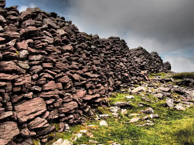
Photo: Caherconree Promontory Fort · Stephen Murphy · CC BY-SA 4.0

Promontory forts use a cliff-bound headland or an inland spur, cut off by banks and ditches across the neck. Most are on the coast: take care near cliff edges.
Every promontory fort with a reliable location in the Republic is on the map below. The best-documented ones have a page of their own.
1 of these pages quote recorded folklore - see folklore and traditions.
Where they are
Darker = more recorded. Most in Cork, Kerry, Mayo.
Types recorded
- Promontory fort - coastal503 recorded
- Promontory fort - inland69 recorded
Map of promontory forts
Featured promontory forts
 National Monument
Caherconree Promontory Fort
Promontory fort - inland · Ballyarkane Oughter,Beheenagh (Corkaguiny By.) · Kerry
 National Monument
Dunbeg Fort
Promontory fort - coastal · Fán · Kerry
 National Monument
Dún Dúchathair
Promontory fort - coastal · Cill Éinne · Galway
National MonumentDrumanagh
Promontory fort - coastal · Drumanagh · Dublin
Annagh
Promontory fort - inland · Annagh (Boyle By.) · Roscommon
Beagh
Promontory fort - inland · Beagh · Roscommon
Churchacres
Promontory fort - inland · Churchacres · Roscommon
Dundermot
Promontory fort - inland · Dundermot · Roscommon
Glasleck
Promontory fort - inland · Glasleck · Cavan
Glen (Richards)
Promontory fort - coastal · Glen (Richards) · Wexford
Greaghnaglogh
Promontory fort - inland · Greaghnaglogh · Roscommon
Mullaghglass
Promontory fort - coastal · Mullaghglass · Galway
Promontory Forts by county
| County | On the map | Named, with notes |
|---|---|---|
| Cork | 133 | 0 |
| Kerry | 96 | 2 |
| Mayo | 88 | 0 |
| Donegal | 81 | 0 |
| Waterford | 42 | 0 |
| Clare | 36 | 0 |
| Sligo | 19 | 0 |
| Galway | 15 | 2 |
| Roscommon | 11 | 6 |
| Dublin | 10 | 1 |
| Wexford | 9 | 1 |
| Louth | 7 | 0 |
| Wicklow | 7 | 0 |
| Cavan | 5 | 1 |
| Meath | 5 | 0 |
| Westmeath | 3 | 0 |
| Leitrim | 2 | 0 |
| Kilkenny | 1 | 0 |
| Limerick | 1 | 0 |
| Monaghan | 1 | 0 |
Source: Archaeological Survey of Ireland (SMR, 1 December 2025), National Monuments Service, CC BY 4.0; names from NMS, Wikidata and Fáilte Ireland. Records without a mapped location are not shown.