
Unofficial guide. Not the National Monuments Service, the OPW, Fáilte Ireland or the landowner. Disclaimer
At a glance
- TypePromontory fort - coastal
- Date or period mentioned19th century
- Recorded sizeW 30m; H 2m
- StatusNational Monument
What to look for
- Bank and ditch
- Entrance gap
- Hut sites
- Ramparts
Picked out from the Archaeological Survey description below.
Can you visit?
- No source says it is open to the public.Most monuments in Ireland stand on private farmland.
- Ask the landowner before crossing fields, close gates, leave the stones as you find them.Visiting responsibly
History and description
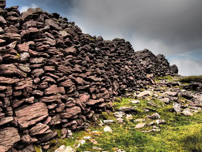
The neck of the headland c. 46 acres is defended by a straight series of earthworks (L. 350m) except where they curve inwards near the S cliff. The elevated, relatively flat promontory at Drumanagh is delimited on its landward (western) side by three closely-spaced earthen banks, each fronted by a ditch, with traces of a fourth, counterscarp, bank beyond the outer ditch.
Full archaeological record 774 words
The neck of the headland c. 46 acres is defended by a straight series of earthworks (L. 350m) except where they curve inwards near the S cliff. The elevated, relatively flat promontory at Drumanagh is delimited on its landward (western) side by three closely-spaced earthen banks, each fronted by a ditch, with traces of a fourth, counterscarp, bank beyond the outer ditch. The inner bank is the best preserved rampart (Wth 30m; H 2m) The remaining banks have been greatly denuded (Wth 17m; H 0.5m). Fosses are silted up. (Wth 4-6m, D 0.1m). A small stream emanates from a pond outside the ramparts to flow along the inner ditch and over the cliff edge at the south-west corner of the promontory. A number of gaps occur along the length of the ramparts, one or more of which may represent an original entrance. There is a Martello tower (DU008-006003-) at the eastern end of the promontory, which was built c. 1804. The original approach to the tower survives as a sunken trackway extending from the south-east corner of the fort. A system of 18th/19th century relict field boundaries defined by low earthen banks and ditches, extend across the northern and southern sides of the promontory.
The LIARI project has examined the available LiDar data in conjunction with previous geophysical survey, carried out on behalf of the NMI, and undertaken geophysical survey (Cahill-Wilson et al 2014). Within the promontory a D-shaped enclosure and several structures suggestive of buildings and/or small enclosures, the presence of burnt material and pits (Dowling 2014, 13). The results reflect ploughing on the fort in the 1970s that revealed hut sites suggesting extensive settlement. Gallo-Roman pottery, second century AD Roman coins, Romano-British fibulae (brooches), copper ingots and an iron horsebit have been found at the site. The most significant feature identified by geophysical survey was located south-west external to the ramparts. It is a large, roughly oval enclosure (c. 42m E-W x 30m N-S). Two well defined breaks, each measuring c. 5m in width, occur on the north-east and south-east sides of the enclosure and may reflect original entrances (Dowling 2014, 16). Ploughing took place external to the outer rampart in the summer of 2014 impinging on the counterscarp fourth bank in the northern half of the site and the newly discovered oval enclosure.
Digging Drumanagh, https://www.fingal.ie/digging-drumanagh, a Fingal County Council community-based research project has undertaken three seasons of excavation at the site. The focus of the Season I excavation in 2018 was the Martello road in the vicinity of the early 19th century Martello tower (DU008-006003-), towards the eastern limit of the headland. Two trenches were excavated and showed that the building of the Martello road disturbed Iron Age deposits. A number of fragments of human bone were also recovered including the cranial fragment of a female aged between 18 and 45 years at the time of death, which was dated to BC 170 – cal. AD 52. A long bone identified as an adult femur was recovered from the area south of the Martello road which returned a date of cal. BC 49 – cal. AD 118 indicating at least two burials in this area. There were also extensive remains associated with the occupants of the Martello Tower (Baker 2018).
The 2019 Season II excavation took place at the other end of the Martello Road, near to the ramparts. Here a prehistoric structure was identified by the post and stakeholes left behind when the wood rotted. Nearby was a structure associated with a weaving comb along with numerous bone points, possible bone tools and a bone needle indicating processing and/or craftworking and textile production was being carried out here. The presence of almost 80 sherds Dressel 20 pottery from the Roman province of Baetica in Southern Spain and other Romano-British material confirms there was significant contact between Drumanagh and the Roman world in the 1st-3rd centuries AD (Baker 2019)
The focus of the 2022 Season III excavation was to determine if a lane or roadway identified on aerial photographs and geophysical survey was of ancient or more modern origin. The lane left little evidence indicating it was of modern date. Instead the collapsed wall of a structure was identified. A deposit rich with animal bone was excavated from within the structure. Sherds of at least four different types of pottery from the Roman world were recovered as were fragments of glass vessels and a number of glass beads (Baker 2022).
To see a 3D model of the fort visit; https://skfb.ly/oEQ7n
This monument is subject to a preservation order made under the National Monuments Acts 1930 to 2014 (PO no. 13/1977).
References
- Baker, C. 2018 Digging Drumanagh Season I, Preliminary Report (Licence C786/E4805). https://www.fingal.ie/digging-drumanagh
- Baker, C. 2019 Digging Drumanagh Season II, Preliminary Report (Licence C786/E4805).
- https://www.fingal.ie/digging-drumanagh
- Baker, C. 2022 Digging Drumanagh Season III, Preliminary Report (Licence C786/E4805). https://www.fingal.ie/digging-drumanagh
- Updated and revised by: Christine Baker
- Date of revised upload: 6 March 2023
Archaeological Survey of Ireland, National Monuments Service (CC BY 4.0) · Compiled by Geraldine Stout. It describes the site as it was when surveyed.
Visitors' notes
Badges are opinions of visitors - not verified facts. One vote per badge and visitor; no account needed.
Best time to visit
What's missing on this page?
Share a tip to find it
Share a local tradition or story
Suggest a correction
Suggest the right map location
Report a duplicate page
Ask a question
Do not include personal data. See our privacy notice.
Around Drumanagh
Other heritage nearby
- Rush Demense ChurchAncient church · 0.8 km
- Rush Demesne Holy WellHoly well · 0.9 km
- Rush Demense CastleCastle · 0.9 km
- Baldongan ChurchAncient church · 3.5 km
- Townparks ChurchAncient church · 4.0 km
- Lady WellHoly well · 4.9 km
Recorded within 5 km
- 4 ancient churchesArchaeological Survey of Ireland
- 4 holy wellsArchaeological Survey of Ireland
- 2 promontory fortsArchaeological Survey of Ireland
- 2 castlesArchaeological Survey of Ireland
- 2 abbeys & friariesArchaeological Survey of Ireland
- 2 monastic sitesArchaeological Survey of Ireland
- 1 megalithic tombArchaeological Survey of Ireland
- 1 ringfortArchaeological Survey of Ireland
- 1 standing stoneArchaeological Survey of Ireland
Outdoors, towns and places to stay
- Loughshinny BeachBeaches · 0.7 km · Good Quality (2025)
- Rush North BeachBeaches · 1.6 km · Excellent Quality (2025)
- Rogerstown Estuary Nature ReserveNature reserves · 5.3 km
- Baldoyle Estuary Nature ReserveNature reserves · 16 km
- Georgian TownhouseHistoric stays · 25 km
Other attractions nearby
- Rush, South BeachBeach · 2.5 km
- Skerries South BeachNature and Wildlife · 4.7 km
- St Patrick’s Way and Art Trail SkerriesWalking · 4.8 km
- Wild Fowl ReservesNature and Wildlife · 5.3 km
What's on nearby
- ON ICE Swords2026-11-05 · 13 km
- ON ICE Swords2026-11-06 · 13 km
- Andy Irvine & Quilty2026-11-06 · 15 km