
Unofficial guide. Not the National Monuments Service, the OPW, Fáilte Ireland or the landowner. Disclaimer
At a glance
- TypePromontory fort - coastal
- Recorded size 32m E-W; 29m N-S
What to look for
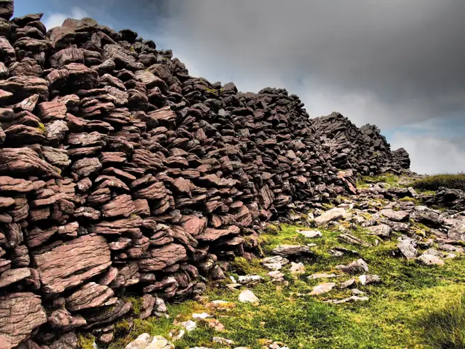
- Bank and ditch
Picked out from the Archaeological Survey description below.
Can you visit?
- No source says it is open to the public.Most monuments in Ireland stand on private farmland.
- Ask the landowner before crossing fields, close gates, leave the stones as you find them.Visiting responsibly
History and description
Situated on the coast at Polshone Head with the sea immedately adjacent NW-SE and a ravine on the S side. This grass-covered area is defended by two fosses.
Full archaeological record 141 words
Situated on the coast at Polshone Head with the sea immedately adjacent NW-SE and a ravine on the S side. This grass-covered area is defended by two fosses. The inner enclosure is subcircular or D-shaped (dims. 32m E-W; 29m N-S) defined by scarps (H 1.6-2m) at N and S and destroyed by sea erosion at E, but a curving bank (Wth 5m; int. H 0.4m; ext. H 1.2m) with an external fosse (Wth of top 8m; Wth of base 3m; D 1.2m) and counterscarp bank (Wth c. 4m; ext. H 0.3m) survive S-NW. The outer enclosure to the W is triangular (dims. 28m E-W; 23m N-S at E) with the apex at W whre it is defined by a fosse across the promontory (Wth of top 6m; D 2m). The inner enclosure may have been a rath imposed on earlier defences.
Archaeological Survey of Ireland, National Monuments Service (CC BY 4.0) · Compiled by Michael Moore · Updated 13 April, 2012 · Based on the Archaeological Inventory of County Wexford. It describes the site as it was when surveyed.
Visitors' notes
Badges are opinions of visitors - not verified facts. One vote per badge and visitor; no account needed.
Best time to visit
What's missing on this page?
Share a tip to find it
Share a local tradition or story
Suggest a correction
Suggest the right map location
Report a duplicate page
Ask a question
Do not include personal data. See our privacy notice.
Around Glen (Richards)
Other heritage nearby
- Lady's WellHoly well · 4.1 km
- TobermurryHoly well · 8.9 km
- St Winifred's WellHoly well · 9.8 km
Recorded within 5 km
- 4 ancient churchesArchaeological Survey of Ireland
- 4 ringfortsArchaeological Survey of Ireland
- 2 castlesArchaeological Survey of Ireland
- 1 promontory fortArchaeological Survey of Ireland
- 1 high crossArchaeological Survey of Ireland
- 1 abbey or friaryArchaeological Survey of Ireland
- 1 holy wellArchaeological Survey of Ireland
Walks and trails
- Courtown Woods Trails - River WalkWalking Trail · 2.1 km · nearest point 3.4 km
- Courtown Woods Trails - Canal WalkWalking Trail · 0.7 km · nearest point 3.4 km
- Courtown - Kiltennel TrailWalking Trail · 2.4 km · nearest point 3.4 km
Outdoors, towns and places to stay
- Courtown, North BeachBeaches · 3.4 km · Excellent Quality (2025)
- CahoreBeaches · 5.4 km
Other attractions nearby
- Ardamine BeachBeach · 1.7 km
- Roney Point BeachBeach · 2.1 km
- Courtown BeachBeach · 3.2 km
- Glascarrig BeachBeach · 4.1 km
What's on nearby
- Gorey Whiskey Festival 20262026-11-06 · 8.2 km
- Gorey Whiskey Festival 20262026-11-07 · 8.2 km
- Winter Fair and Santa Paws2026-11-15 · 13 km · free
Excavations nearby
- E3492 Raheenagurren West Site 30, County WexfordRoad-scheme excavation report (TII) · 6.1 km
- E3490 Raheenagurren West Site 26, County WexfordRoad-scheme excavation report (TII) · 6.2 km