
Unofficial guide. Not the National Monuments Service, the OPW, Fáilte Ireland or the landowner. Disclaimer
At a glance
- TypeEcclesiastical enclosure
Picked out from the Archaeological Survey description below.
Can you visit?
- No source says it is open to the public.Most monuments in Ireland stand on private farmland.
- Ask the landowner before crossing fields, close gates, leave the stones as you find them.Visiting responsibly
History and description
This site is located at the mouth of a valley on the lower W slopes of Mullaghnarakill mountain. Situated on a fairly level terrace on the N side of the valley, it commands extensive views to W. Running below it, to S, is a tributary of the Ferta river.
Full archaeological record 545 words
This site is located at the mouth of a valley on the lower W slopes of Mullaghnarakill mountain. Situated on a fairly level terrace on the N side of the valley, it commands extensive views to W. Running below it, to S, is a tributary of the Ferta river. The site is currently being excavated as part of UCC's undergraduate training programme (Sheehan 1994a, 41-2). The following report describes the features and structures that were visible before excavation.
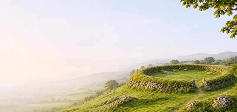
The original enclosing element survives only from E through to SW, where it barely rises above the internal ground level of the site. It is a rubble-built wall with an outer facing of large, horizontally laid slabs. It averages 1.8m wide and 1m high externally. The remains of an entrance feature survive at E and consist of two slabs, 1.35m apart, set at right angles to the line of the enclosing wall. Elsewhere, modern field walls and a laneway flank the site at N, NE and W. The enclosed area presently measures 20.6m N-S x 30m E-W, though a short, low stretch of a tree-lined bank, located on the N side of the laneway, may represent the limits of the site here.
The NE quadrant is raised above the remainder of the site and is largely occupied with uninscribed upright slabs. It is locally known as a ceallúnach, and children were buried here up to the early twentieth century. Two cross-slabs and an unusual shrine occur in the SE portion of this area.
Shrine (KE070-043003-): This poorly preserved feature consists of a rectangular mound, 2.9m N-S x 1.9m E-W, which is retained by upright slabs set on edge. A number of these slabs are missing or buried, particularly at N, while the remainder tend to incline outward. Low pillars occur at the SE, SW and NW corners of the structure. The mound is largely composed of stone, including some quartz and its upper surface appears to be paved with slabs. It appears to be a variant type of corner-post shrine.
Cross-Slabs: (1) (KE070-043002-) This narrow slab stands just outside the NW angle of the shrine. It is 1.15m high and tapers toward its base from a maximum width of .27m. Its top edge is divided by a deep notch. On its W face is a linear latin cross with outwardly disposed C-scroll terminals. Beneath this is a roundel containing four similarly disposed C-scroll motifs.
(2) (KE070-043004-) Standing just to S of (1), this slab is .75m high and .23m wide at the top, broadening gradually to a maximum width of .45m near its base. On its W face is an encircled Maltese cross. Its centre is separated from the arms by grooves and it features a small central dot. Pendant from the encircled cross is a grooved stem, divided midway by a lozenge-shaped expansion and ending in a small triangular expansion. Below this, on either side, are two S-shaped motifs, on edge, while a stylised bird is outlined in profile above.
(3) (KE070-043005-) A fragment of a third cross-slab was noted at the site (Macalister 1939b, 21), but its present location is unknown. A photograph, apparently taken during the 1950s, clearly indicates that this slab featured a Maltese cross or a cross of arcs (information: P. Harbison).
Archaeological Survey of Ireland, National Monuments Service (CC BY 4.0) · Updated 30 July 2013 · Based on the A. O'Sullivan and J. Sheehan. It describes the site as it was when surveyed.
More monastic sites nearby
 National Monument
Church Island - Valentia Harbour
Ecclesiastical enclosure · Church Island (Iveragh By., Castlequin Ed) · Kerry · 15 km away
 National Monument
Church Island - Lough Currane
Ecclesiastical site · Church Island (Iveragh By., Loughcurrane Ed) · Kerry · 17 km away
 National Monument
Illaunloughan
Ecclesiastical enclosure · Illaunloughan,Portmagee · Kerry · 23 km away
Kilfountan monastic settlement
Ecclesiastical enclosure · Cill Fhiontain · Kerry · 25 km away
National MonumentMaumanorig Early Medieval Ecclesiastical Site
Ecclesiastical enclosure · Mám An Óraigh · Kerry · 26 km away
National MonumentReenconnell
Ecclesiastical enclosure · Rinn Chonaill · Kerry · 27 km away
Visitors' notes
Badges are opinions of visitors - not verified facts. One vote per badge and visitor; no account needed.
Best time to visit
What's missing on this page?
Share a tip to find it
Share a local tradition or story
Suggest a correction
Suggest the right map location
Report a duplicate page
Ask a question
Do not include personal data. See our privacy notice.
Around Caherlehillan Early Christian Site
Other heritage nearby
- Srugreana ChurchAncient church · 5.7 km
- TobergobnetHoly well · 5.7 km
Recorded within 5 km
- 21 ringfortsArchaeological Survey of Ireland
- 9 standing stonesArchaeological Survey of Ireland
- 3 megalithic tombsArchaeological Survey of Ireland
- 1 ancient churchArchaeological Survey of Ireland
- 1 ogham stoneArchaeological Survey of Ireland
- 1 monastic siteArchaeological Survey of Ireland
Walks and trails
- Kingdom of Kerry Greenways - South Kerry GreenwayGreenway · 9.2 km · nearest point 2.0 km
- Kingdom of Kerry Greenways - South Kerry GreenwayGreenway · 9.2 km · nearest point 2.0 km
- Kerry WayLong Distance Waymarked Way · 232.1 km · nearest point 5.9 km
Outdoors, towns and places to stay
- KimegoForests · 12 km
- LickeenForests · 14 km
- KellsBeaches · 4.8 km · Excellent Quality (2025)
- Rossbeigh, White StrandBeaches · 11 km · Excellent Quality (2025)
- Cummeragh River Bog Nature ReserveNature reserves · 13 km
- Lough Nambrackdarrig Nature ReserveNature reserves · 16 km
- Old Cable Historic HouseHistoric stays · 18 km
Other attractions nearby
- Kells Sheepdogs, Ring of KerryNature and Wildlife · 5.2 km
- Mountain StageNature and Wildlife · 6.3 km
- Oileán AdventuresNature and Wildlife · 11 km
- The Old BarracksHistoric Houses and Castle · 11 km