
Unofficial guide. Not the National Monuments Service, the OPW, Fáilte Ireland or the landowner. Disclaimer
At a glance
- TypeEcclesiastical enclosure
- Date or period mentioned19th century
- Condition (as surveyed)Gone: no visible trace
- StatusNational Monument
What to look for
- Carved stonework
Picked out from the Archaeological Survey description below.
Can you visit?
- No source says it is open to the public.Most monuments in Ireland stand on private farmland.
- Ask the landowner before crossing fields, close gates, leave the stones as you find them.Visiting responsibly
History and description
National Monument No. 10044. Kilcolman/Cill na gColmán: An Early Christian church site lying on the S slopes of an E-W spur of Lateevemore, overlooking Ventry Harbour.
Full archaeological record 939 words
National Monument No. 10044. Kilcolman/Cill na gColmán: An Early Christian church site lying on the S slopes of an E-W spur of Lateevemore, overlooking Ventry Harbour. It consists of a circular enclosure within which are the reputed site of a church (1), the foundations of at least two huts (2) and a number of graves and gravemarkers (3) which probably relate to the use of the site, until the 19th century, as a calluragh burial ground (KE042-141005-) (OSNB Marhin, 14). Also within the site are a cross-inscribed ogham stone (4), a small cross-inscribed stone (5), a holed stone (6) and 3 bullaun stones (7). Another cross-inscribed stone (8) has been incorporated into the lane boundary wall on the N side of the field in which the enclosure is situated, and S of the enclosure is a holy well (9) dedicated to St. Brendan.
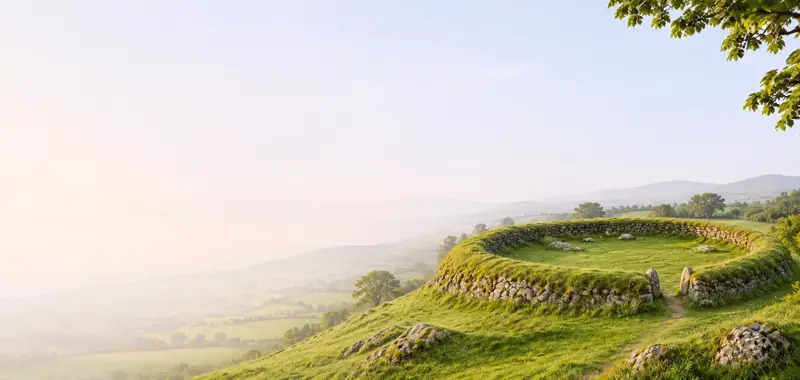
The enclosure, 44m N-S x 47m E-W internally, is defined by an earthen bank, faced in parts with drystone walling, and overlain or replaced in sections by modern stone walls. The SW sector is defined by a straight field wall but a slight platform outside this probably indicates the original outline. Where best preserved the bank averages about 1m in height. A narrow terrace outside the S part of the enclosure is revetted on its downslope edge with drystone masonry. There is a 2m wide entrance gap at NW. The interior slopes downhill to SW but is divided E-W into an upper and lower terrace by a low meandering scarp.
(1) The site of the church (KE042-141002-) as marked on the OS maps lies in the E part of the upper terrace. It is now occupied by a roughly oval mound of stones, to the W of which is a large sub-rectangular hollow. The mound is a maximum of .5m in height and a central depression in its surface measures c. 4m E-W x 3m N-S. The rectangular hollow measures 3m N-S x c. 7.8m E-W and is a maximum of 1m deep.
(2) The ruined foundations of a rectangular structure, 7.2m N-S x 3m E-W, can be seen on the roughly circular level terraced area at the W side of the enclosure. Directly N of this is a stone and earth mound measuring c. 5m x 3m up to 1.2m in height; its origin is not known.
Abutting the enclosure bank at S is a circular foundation, c. 3.9m in diameter, its S side defined by the enclosing bank and its N side by a low stony bank no more than .3m high.
(3) The visible graves and gravemarkers are confined to the SW quadrant of the enclosure. The most clearly defined grave lies 5m NW of the ogham stone and consists of a low, roughly rectangular mound, 2.25m long NW-SE, its SW side delimited by 3 stones set on edge. The position of other graves are indicated by mounds, low upright stones or prostrate slabs. On the OS maps, graves were also marked in the NE part of the site, and the presence of 2 piles of quartz pebbles here, on the mound of stones already described (1), suggests that this area was reused for calluragh burials.
(4) (KE042-141006-) Standing near the SE edge of the enclosure is a large irregularly-shaped boulder, its W face inscribed with an ogham inscription and 2 crosses. It measures 1.15m in height, 1.58m in length and .54m in thickness.
The stem line for the ogham inscription was carved up the left side of the face and across the top, framing the crosses. The ogham scores are clearly legible but the inscription is confused and puzzling. Macalister's ingenious interpretation may be correct (1945, 186-8). He suggested that the inscription intended was:
ANM COLMAN AILITHIR
and that the peculiarities can be explained as an attempt to correct mistakes made during its execution.
The main cross motif is a deeply carved cross of arcs within a circle, its lower arm linked to the circle by a short stem. This latter continues beyond the circle to below the present ground surface and exhibits a triangular expansion at about its mid-point. An equal-armed cross with fishtail-like terminals occupies the upper right portion of this face of the stone.
(5) A small stone, measuring .41 x .23m, is inscribed on one face with a plain Latin cross. It now lies loose in the NE part of the enclosure but may formerly have acted as a gravemarker.
(6) (KE042-141008-) Also lying loose in the NE part of the site is a holed stone measuring .4m x .43m x .07m thick, the circular perforation measuring .04m in diameter.
(7) Three bullaun stones collected from various parts of the site have now been set in the ground in front of the ogham stone. The largest is .44m x .33m x .08m thick with an oval depression, .24 x .21m in diameter x .06m deep. The other two measure .28m x .2m and .21m x .21m respectively, their circular depressions measuring .11m in diameter x .03m in depth and .08m in diameter x .02m in depth.
(8) The stone set into the lane wall to N of the enclosure is .75m high and .66m wide and its outer face is inscribed with a cross with expanded terminals.
(9) The 3 springs that issue from the ground about 80m S of the enclosure are probably the holy well (KE042-141010-) mentioned by Curran (no.2) and Henry (1937, 277-8). According to Curran, pilgrimages to it ceased in the early part of the 19th century, but Henry noted that rounds were still being made and that it was dedicated to St. Brendan.
Archaeological Survey of Ireland, National Monuments Service (CC BY 4.0) · Updated 9 August 2013 · Based on the J. Cuppage, ‘Corca Dhuibhne. Dingle Peninsula archaeological survey. Ballyferriter. Oidhreacht Chorca Dhuibhne. It describes the site as it was when surveyed.
More monastic sites nearby

Gallarus monastic site
Ecclesiastical enclosure · Gallaras · Kerry · 3.3 km away
 Visitor site National Monument
Reask Monastic Site
Ecclesiastical enclosure · An Riasc · Kerry · 3.3 km away
Kilfountan monastic settlement
Ecclesiastical enclosure · Cill Fhiontain · Kerry · 3.9 km away
 National Monument
Kilmalkedar
Ecclesiastical site · Cill Maoilchéadair · Kerry · 4.8 km away
National MonumentReenconnell
Ecclesiastical enclosure · Rinn Chonaill · Kerry · 6.0 km away
 National Monument
Church Island - Valentia Harbour
Ecclesiastical enclosure · Church Island (Iveragh By., Castlequin Ed) · Kerry · 23 km away
Visitors' notes
Badges are opinions of visitors - not verified facts. One vote per badge and visitor; no account needed.
Best time to visit
What's missing on this page?
Share a tip to find it
Share a local tradition or story
Suggest a correction
Suggest the right map location
Report a duplicate page
Ask a question
Do not include personal data. See our privacy notice.
Around Maumanorig Early Medieval Ecclesiastical Site
Other heritage nearby
- Rahinnane CastleCastle · 1.7 km
- ToberbreedaHoly well · 2.0 km
- Temple-ManaghanAncient church · 2.2 km
- Gallarus OratoryAncient church · 3.3 km
- Gallarus CastleCastle · 3.6 km
- Ballywiheen ChurchAncient church · 3.7 km
Recorded within 5 km
- 71 ringfortsArchaeological Survey of Ireland
- 26 standing stonesArchaeological Survey of Ireland
- 20 holy wellsArchaeological Survey of Ireland
- 18 ancient churchesArchaeological Survey of Ireland
- 14 ogham stonesArchaeological Survey of Ireland
- 11 monastic sitesArchaeological Survey of Ireland
- 9 promontory fortsArchaeological Survey of Ireland
- 4 megalithic tombsArchaeological Survey of Ireland
- 4 castlesArchaeological Survey of Ireland
- 1 high crossArchaeological Survey of Ireland
Walks and trails
- Dingle - Siuloid CholmainWalking Trail · 7.5 km · nearest point 0.2 km
- Cosan na Naomh (Saints Road)Pilgrim Path · 17.7 km · nearest point 0.2 km
- Dingle WayLong Distance Waymarked Way · 163.0 km · nearest point 1.5 km
Outdoors, towns and places to stay
- Fionntrá (Ventry)Beaches · 1.5 km · Excellent Quality (2025)
- Béal BánBeaches · 5.3 km
- Mount Brandon Nature ReserveNature reserves · 16 km
- DingleWalled towns · 6.3 km
Other attractions nearby
- Blasket Islands Eco Marine ToursNature and Wildlife · 0.9 km
- Blasket Islands Eco Marine and Whale Watching ToursNature and Wildlife · 1.3 km
- Celtic Nature Walking ToursNature and Wildlife · 2.4 km
- From Fionn MacCumhail to Com DhíneolNature and Wildlife · 2.8 km
What's on nearby
- Dingle Literary Festival 20262026-11-20 · 6.0 km
- Dingle Literary Festival 20262026-11-21 · 6.0 km
- Dingle Literary Festival 20262026-11-22 · 6.0 km