


Unofficial guide. Not the National Monuments Service, the OPW, Fáilte Ireland or the landowner. Disclaimer
At a glance
- TypeEcclesiastical enclosure
- Date or period mentionedEarly Medieval
- StatusNational Monument
Picked out from the Archaeological Survey description below.
Can you visit?
- No source says it is open to the public.Most monuments in Ireland stand on private farmland.
- Ask the landowner before crossing fields, close gates, leave the stones as you find them.Visiting responsibly
History and description
National Monument No. 59. Church Island/Oileán an Teampaill: This small island is located at the N end of Valencia Harbour, midway between the SE end of Beginish Island and the mainland at Ballycarbery.
Full archaeological record 729 words
National Monument No. 59. Church Island/Oileán an Teampaill: This small island is located at the N end of Valencia Harbour, midway between the SE end of Beginish Island and the mainland at Ballycarbery. Formed of diorite, it rises to a height of 12.6m above OD, and has a habitable surface of .17ha. During vernal equinoctial tides the site may be reached on foot from Beginish along a sand-bar. At other times access is gained by boat, and a projecting slope of rock at E serves as a natural slip-way. On the OS maps an 'Oratory' and 'Cloghaun' are marked on the island. These remains were erroneously identified by O'Hanlon as the monasterium Ibracense founded by St Malachy in Munster c. 1127 (1872, 107-13). Before the site was excavated, under the direction of M.J. O'Kelly in 1955-56, its only visible features were the oratory and cloghaun, an ogham-inscribed cross-slab and traces of an enclosing wall. The excavations revealed a further series of structures and features that demonstrated the occurrence of two phases of Early Medieval occupation on the island. They also provided some evidence for its temporary occupation in the Later Medieval period. The following description of the site is largely based on the report of these excavations (O'Kelly 1958, 57-136).
Evidence for the earliest period of occupation on the island comprised a circular wooden hut and a rectangular wooden building. The latter feature was associated with a group of burials and was interpreted as an oratory. Though not demonstrably related stratigraphically, the hut and oratory were probably contemporary. The remains of the hut, located towards the centre of the island, consisted of an arc of low stones set on edge, two post-holes and an occupation layer. The latter included charcoal, shells, animal bones and the remains of a pit furnace. The structure may have had a diameter of up to 6m. The wooden oratory (KE079-032014-), located midway between the hut and the W shore of the island, was evidenced by five post-holes, indicating a small rectangular structure measuring approximately 3m x 2m and orientated ENE-WSW on its longer axis. Wallace, however, has suggested that if the post-holes are interpreted as being for roof-supports, rather than for corner-posts, the building may have had dimensions of c. 5m x c. 3.5m (1982, 21-3). To N and NW of the wooden oratory was a cemetery of at least thirty-three burials. Most of the graves were of simple dug type, while two were slab-lined. All were of similar orientation to the wooden Oratory, and were considered to be contemporary with it.
The excavations indicated a clear sequence of development during the island's second phase of occupation, which may have followed directly on the first. A stone Oratory was constructed on the site of the wooden structure and, apparently at the same time, the wooden hut was replaced by a circular stone house. The evidence also indicated that shortly after this the house was furnished with an annulus, and a water cistern was made beside it. Some time later a rectangular stone house was built near the NE edge of the island, and an enclosure wall was subsequently constructed around the island's habitable area. At least eight of the numerous burials uncovered during the excavation appear to be contemporary with the stone oratory, as do two gable finials. It is unclear, however, whether the ogham-inscribed cross-slab, the shrine, the two cross-slabs and the two stone crosses found during the excavation belong to the island's first or second phase of occupation.
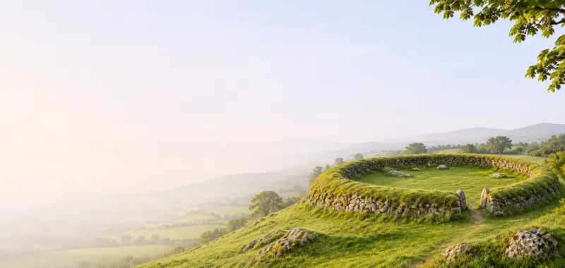
Enclosure Wall: Excavation showed this wall to have been built after the construction of the rectangular stone house. It does not survive in the eroded SW sector of the island, but elsewhere varies from 1.5m to 2m in basal width and survives to a maximum height of 1m. It is drystone-faced internally and externally and features a core of rubble and earth. It encloses most of the habitable surface of the island, but runs along the inner side of the rectangular house at NW. An entrance, .6m wide, is located here, and a paved path leads through it to the oratory. A second entrance occurs at SE, close to the natural slip-way. It measures .6m wide and features paving and well-built jambs; it gave access to paved paths, now largely destroyed, which led N and S along the inner circuit of the enclosure wall.
Archaeological Survey of Ireland, National Monuments Service (CC BY 4.0) · Updated 29 July 2013 · Based on the A. O'Sullivan and J. Sheehan. It describes the site as it was when surveyed.
More monastic sites nearby
 National Monument
Illaunloughan
Ecclesiastical enclosure · Illaunloughan,Portmagee · Kerry · 8.4 km away
Caherlehillan Early Christian Site
Ecclesiastical enclosure · Caherlehillan · Kerry · 15 km away
 National Monument
Church Island - Lough Currane
Ecclesiastical site · Church Island (Iveragh By., Loughcurrane Ed) · Kerry · 15 km away
National MonumentMaumanorig Early Medieval Ecclesiastical Site
Ecclesiastical enclosure · Mám An Óraigh · Kerry · 23 km away
Kilfountan monastic settlement
Ecclesiastical enclosure · Cill Fhiontain · Kerry · 25 km away
 Visitor site National Monument
Reask Monastic Site
Ecclesiastical enclosure · An Riasc · Kerry · 27 km away
Also recorded nearby
Named sites within 5 km with only a short entry in the Archaeological Survey.
- Kilmore ChurchChurch · Farranreagh · 2.2 km · official record
This church is listed in the SMR (1990). According to Lewis (1837, vol. 2, 673), this is a small plain building with a square tower, erected in 1815.
Visitors' notes
Badges are opinions of visitors - not verified facts. One vote per badge and visitor; no account needed.
Best time to visit
What's missing on this page?
Share a tip to find it
Share a local tradition or story
Suggest a correction
Suggest the right map location
Report a duplicate page
Ask a question
Do not include personal data. See our privacy notice.
Around Church Island - Valentia Harbour
Other heritage nearby
- Ballycarbery CastleCastle · 2.1 km
- Church at FarranreaghAncient church · 2.5 km
- CahergallRingfort · 2.7 km
- LeacanabuaileRingfort · 2.7 km
- ToberreendoneyHoly well · 3.4 km
- Inch ChurchAncient church · 3.9 km
Recorded within 5 km
- 15 ringfortsArchaeological Survey of Ireland
- 9 ancient churchesArchaeological Survey of Ireland
- 8 standing stonesArchaeological Survey of Ireland
- 7 promontory fortsArchaeological Survey of Ireland
- 5 holy wellsArchaeological Survey of Ireland
- 4 castlesArchaeological Survey of Ireland
- 4 monastic sitesArchaeological Survey of Ireland
- 3 megalithic tombsArchaeological Survey of Ireland
- 2 ogham stonesArchaeological Survey of Ireland
Walks and trails
- Cullum's Cup Main LoopWalking Trail · 7.9 km · nearest point 1.3 km
- Cullum's Cup Kilbeg LoopWalking Trail · 4.9 km · nearest point 1.6 km
- Cahirsiveen - Carhan Letter LoopWalking Trail · 11.1 km · nearest point 3.4 km
Outdoors, towns and places to stay
- KimegoForests · 4.8 km
- White Strand, CaherciveenBeaches · 0.8 km · Excellent Quality (2025)
- Cúas CromBeaches · 3.3 km · Excellent Quality (2025)
- Puffin Island Nature ReserveNature reserves · 14 km
- Puffin Island Nature ReserveNature reserves · 14 km
- Old Cable Historic HouseHistoric stays · 14 km
Other attractions nearby
- Kerrys' Marine Park Wildlife - AquaTerra Boat ToursNature and Wildlife · 1.2 km
- Ultimate Skellig Coast Tour - AquaTerra Boat ToursNature and Wildlife · 1.2 km
- Valentia Island Experience - AquaTerra Boat ToursNature and Wildlife · 1.2 km
- Skellig Michael Landing Adventure - AquaTerra Boat ToursNature and Wildlife · 1.2 km