
Unofficial guide. Not the National Monuments Service, the OPW, Fáilte Ireland or the landowner. Disclaimer
At a glance
- TypeEcclesiastical enclosure
- Date or period mentioned19th century
Picked out from the Archaeological Survey description below.
Can you visit?
- No source says it is open to the public.Most monuments in Ireland stand on private farmland.
- Ask the landowner before crossing fields, close gates, leave the stones as you find them.Visiting responsibly
History and description
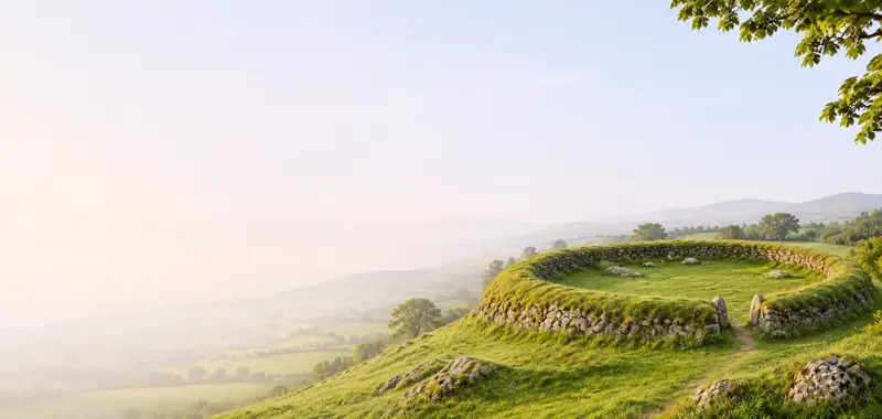
Kilfountan Church and Calluragh burial ground/Teampall Fionntain: A roughly D-shaped or sub-oval enclosure within which are the remains of an oratory and rectangular hut, a cross-inscribed ogham stone and a bullaun stone. A quernstone from the site, probably of Disc A type (Caulfield 1969, 64 and 69), is now in the Museum in Cork.
Full archaeological record 722 words
Kilfountan Church and Calluragh burial ground/Teampall Fionntain: A roughly D-shaped or sub-oval enclosure within which are the remains of an oratory and rectangular hut, a cross-inscribed ogham stone and a bullaun stone. A quernstone from the site, probably of Disc A type (Caulfield 1969, 64 and 69), is now in the Museum in Cork. Children were still being buried here in the 19th century (OSNB Kildrum, 31). The site is located in the low-lying, level plain that lies N of Dingle Harbour.
The enclosure measures 41m N-S x 28m E-W internally and is defined by a stone-faced earthen bank which reaches a maximum height of .9m at WSW. The interior is raised slightly above the external ground level and along the SE sector the enclosure is defined only by the stone-faced edge of this platform. The bank along the W half of the site is curiously irregular in comparison with the regular curve of the remainder of the outline and it may be a later field boundary. It does not differ significantly from the adjacent field fences and there is no obvious break between it and the fence that continues from it to N. It is not clear where the original entrance lay.
The interior is divided NNE-SSW internally by a low bank, no more than .3m high. At its SW end, this bank merges with an irregular stone and earth mound of uncertain origin. A short distance to NE of this there is a 1.2m wide entrance gap through the dividing bank.
Hut site (KE043-144004-): The foundations of a rectangular hut lie in the N corner of the E part of the enclosure, the enclosure bank and internal dividing bank forming its W and N walls. It measures c. 5.2m E-W x 4.15m N-S internally. The walls are largely reduced to low banks but the inner face is preserved to a height of .42m at the NW and SW corners.
Oratory (KE043-144003-): In the SE sector of the enclosure are the remains of a dry stone oratory 3.75m ESE-WNW x 3.15m NNE-SSW internally. The S, E and W walls are only partially preserved, but the corbel-built N wall stands to a height of 1.38m and is 1.8m thick. The doorway in the W wall, .7m wide, now lacks its head; a large flag lying in the interior may originally have been a door lintel.
Cross-slab (KE043-144005-): This is set loosely into the W side of a mound of quartz which merges with the collapse from the NE corner of the oratory. An arc of stone collapse, of uncertain origin, extends W from the N end of this mound. The cross-slab is a slender pillar standing 1.5m high and measuring .25 to .09m in width and its decorated S face is peculiarly spatulate in shape. The NE angle of the stone forms the stem-line for an ogham inscription that reads:
EQODD
According to Macalister (1945, 179-80), the name ended with an I but there is now no trace of the relevant scores.
The upper part of the S face is occupied by an equal-armed cross with expanded terminals which is enclosed within a circle. This is surmounted by a scrolled crest, joined to the top of the circle by a short stem. Beneath the cross, but not pendant from it, is an elaborate design which ends in a pelta motif. Directly below the circle, a wide curved band runs across the width of the face and a circular boss has been left in relief at each end of this. Pendant from each end are a curved line which runs to meet the edge of the stone and a 2nd line which develops into the pelta design. Another line, pendant from the centre of the band, extends for a short distance between the latter.
Below the ornament is an inscription in half-uncial script which reads:
(F)INTEN
To left of this, Macalister (1937, 221-7) deciphered the word SCI, preceded by a Chi-Rho. However, though there are vague traces of possible letters in this area, they do not form any recognisable pattern.
Bullaun Stone: Lying loose beside the cross-slab, this stone measures .74m x .56m x .21m in depth. It is roughly rectangular in plan and basin-shaped in section and the oval depression in its upper surface measures .42m x .29m x .15m in depth.
Archaeological Survey of Ireland, National Monuments Service (CC BY 4.0) · Updated 8 August 2013 · Based on the J. Cuppage, ‘Corca Dhuibhne. Dingle Peninsula archaeological survey. Ballyferriter. Oidhreacht Chorca Dhuibhne. It describes the site as it was when surveyed.
More monastic sites nearby
Reenconnell
Ecclesiastical enclosure · Rinn Chonaill · Kerry · 3.1 km away

Gallarus monastic site
Ecclesiastical enclosure · Gallaras · Kerry · 3.4 km away
 National Monument
Kilmalkedar
Ecclesiastical site · Cill Maoilchéadair · Kerry · 3.6 km away
National MonumentMaumanorig Early Medieval Ecclesiastical Site
Ecclesiastical enclosure · Mám An Óraigh · Kerry · 3.9 km away
 Visitor site National Monument
Reask Monastic Site
Ecclesiastical enclosure · An Riasc · Kerry · 5.6 km away
 National Monument
Church Island - Valentia Harbour
Ecclesiastical enclosure · Church Island (Iveragh By., Castlequin Ed) · Kerry · 25 km away
Visitors' notes
Badges are opinions of visitors - not verified facts. One vote per badge and visitor; no account needed.
Best time to visit
What's missing on this page?
Share a tip to find it
Share a local tradition or story
Suggest a correction
Suggest the right map location
Report a duplicate page
Ask a question
Do not include personal data. See our privacy notice.
Around Kilfountan monastic settlement
Other heritage nearby
- Kilfountan ChurchAncient church · 0.0 km
- Temple-ManaghanAncient church · 1.7 km
- ToberbreedaHoly well · 1.9 km
- Caherdorgan NorthRingfort · 3.3 km
- Gallarus OratoryAncient church · 3.4 km
- Kilmalkedar ChurchAncient church · 3.6 km
Recorded within 5 km
- 71 ringfortsArchaeological Survey of Ireland
- 25 standing stonesArchaeological Survey of Ireland
- 18 holy wellsArchaeological Survey of Ireland
- 13 ancient churchesArchaeological Survey of Ireland
- 12 monastic sitesArchaeological Survey of Ireland
- 6 ogham stonesArchaeological Survey of Ireland
- 6 castlesArchaeological Survey of Ireland
- 4 promontory fortsArchaeological Survey of Ireland
- 2 high crossesArchaeological Survey of Ireland
- 2 megalithic tombsArchaeological Survey of Ireland
Walks and trails
- Cosan na Naomh (Saints Road)Pilgrim Path · 17.7 km · nearest point 3.0 km
- Dingle WayLong Distance Waymarked Way · 163.0 km · nearest point 3.2 km
- Dingle - Siuloid CholmainWalking Trail · 7.5 km · nearest point 3.7 km
Outdoors, towns and places to stay
- Fionntrá (Ventry)Beaches · 4.9 km · Excellent Quality (2025)
- Béal BánBeaches · 7.3 km
- Mount Brandon Nature ReserveNature reserves · 13 km
- DingleWalled towns · 3.3 km
Other attractions nearby
- From Fionn MacCumhail to Com DhíneolNature and Wildlife · 1.9 km
- Celtic Nature Walking ToursNature and Wildlife · 2.0 km
- Writers WallAttraction · 2.4 km
- Cuan an Daingin (Dingle Harbour)Natural Landscape · 2.9 km
What's on nearby
- Dingle Literary Festival 20262026-11-20 · 3.0 km
- Dingle Literary Festival 20262026-11-21 · 3.0 km
- Dingle Literary Festival 20262026-11-22 · 3.0 km