


Unofficial guide. Not the National Monuments Service, the OPW, Fáilte Ireland or the landowner. Disclaimer
At a glance
- TypeCross - High cross
- Date or period mentioned12th-century
- StatusNational Monument
What to look for
- Carved scenes
Picked out from the Archaeological Survey description below.
Can you visit?
- No source says it is open to the public.Most monuments in Ireland stand on private farmland.
- Ask the landowner before crossing fields, close gates, leave the stones as you find them.Visiting responsibly
History and description
Erected c. 2006 in the middle of the ‘sacristy’ situated N of the chancel in Kilfenora Cathedral (CL016-015002-) due to weathering. Listed in the SMR (1992) and the RMP (1996) as ‘Cross’.
Full archaeological record 305 words
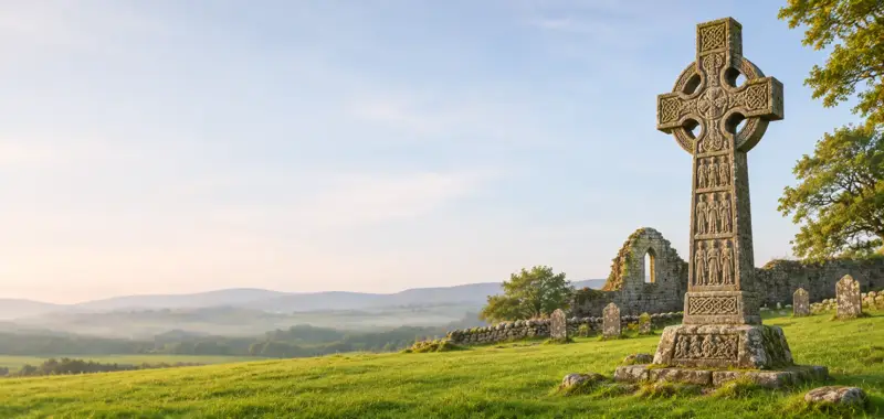
Erected c. 2006 in the middle of the ‘sacristy’ situated N of the chancel in Kilfenora Cathedral (CL016-015002-) due to weathering. Listed in the SMR (1992) and the RMP (1996) as ‘Cross’. This is the 12th-century high cross known as the ‘Doorty’ cross which formerly stood in the graveyard (CL016-015003-) W of the church. It was one of originally 6 limestone high crosses at Kilfenora, five of which are still there (see CL016-015005-, CL016-015007-, CL016-015008-, and CL016-015013-) and one of which was moved to Killaloe in 1821 (CL045-033009-). This cross is constructed from fragments found c. 1956 and later. The lower part was used upside-down by the Doorty family as a tombstone, hence the name. The cross (H 2.83m; Wth 0.75m across the arms) has a tapering shaft (Wth 0.56m at the bottom; T 0.19m) and has an imperforate uneven ringed head. Harbison (1992, vol. 1, 114-15) describes the carved images as follows: E face (now facing W), lower portion: Two clerics, likely to be St. Anthony and St. Paul linking arms, one holding a drop-headed crozier, the other a T-headed one, over a winged beast. Upper portion: An unidentified bishop or abbot (possibly St. Fachtnan, the founder of the church at Kilfenora). S face (now facing N): Above a single human head is a figure with right hand down by the side and with the left hand placed across the chest, holding a book. Above is interlace. W face (now facing E), lower portion: A horseman on top of a shingled roof with ornamental scrolls interlaced by a narrow-bodied animal above. Upper portion: A badly worn crucified Christ. N face (now facing S): An irregular interlace on the shaft surmounted by a chequer-board pattern. (See Harbison 1992 for detailed description.) This is a national monument in State care, no. 8. (de Paor, 1955-6, 55-8)
Archaeological Survey of Ireland, National Monuments Service (CC BY 4.0) · Compiled by Mary Tunney · Updated 19 September 2017. It describes the site as it was when surveyed.
More high crosses nearby
 National Monument
North Cross, Kilfenora
Cross - High cross · Kilfenora · Clare · 0.0 km away
 National Monument
South Cross, Kilfenora
Cross - High cross · Kilfenora · Clare · 0.0 km away
 National Monument
Kilfenora Cathedral and Crosses
Cross - High cross · Kilfenora · Clare · 0.0 km away
National MonumentMollaneen High Cross
Cross - High cross · Mollaneen · Clare · 14 km away
Also recorded nearby
Named sites within 5 km with only a short entry in the Archaeological Survey.
- Noughaval Round TowerRound tower · Noughaval (Burren By.) · 3.7 km · official record
Visitors' notes
Badges are opinions of visitors - not verified facts. One vote per badge and visitor; no account needed.
Best time to visit
What's missing on this page?
Share a tip to find it
Share a local tradition or story
Suggest a correction
Suggest the right map location
Report a duplicate page
Ask a question
Do not include personal data. See our privacy notice.
Around Doorty's Cross, Kilfenora
Other heritage nearby
- Kilfenora monastic siteMonastic site · 0.1 km
- Kilcarragh ChurchAncient church · 0.5 km
- Noughaval ChurchAncient church · 3.7 km
- Ballyganner TombMegalithic tomb · 3.7 km
- Kilshanny AbbeyAbbey or friary · 5.0 km
- ToberinneenboyHoly well · 5.5 km
Recorded within 5 km
- 116 ringfortsArchaeological Survey of Ireland
- 15 megalithic tombsArchaeological Survey of Ireland
- 11 castlesArchaeological Survey of Ireland
- 6 holy wellsArchaeological Survey of Ireland
- 5 high crossesArchaeological Survey of Ireland
- 5 ancient churchesArchaeological Survey of Ireland
- 2 monastic sitesArchaeological Survey of Ireland
- 2 standing stonesArchaeological Survey of Ireland
- 1 round towerArchaeological Survey of Ireland
- 1 caveArchaeological Survey of Ireland
- 1 abbey or friaryArchaeological Survey of Ireland
Walks and trails
- Doolin Cycle Hub Loop 3Road Cycling Trail · 42.7 km · nearest point 0.5 km
- Doolin Cycle Hub Loop 4Road Cycling Trail · 46.4 km · nearest point 5.4 km
- Doolin Cycle Hub Loop 2Road Cycling Trail · 37.5 km · nearest point 7.2 km
Outdoors, towns and places to stay
- Gragan's WoodForests · 7.7 km
- LahinchBeaches · 11 km · Good Quality (2025)
- FanoreBeaches · 15 km · Excellent Quality (2025)
- Ballyteigue Nature ReserveNature reserves · 5.1 km
- Keelhilla, Slieve Carron Nature ReserveNature reserves · 18 km
- Inchiquin HouseHistoric stays · 11 km
- Newpark HouseHistoric stays · 23 km
Other attractions nearby
- Fiadh Irish WolfhoundsWalking · 6.6 km
- Burren Hill WalksWalking · 9.3 km
- Gleninsheen Wedge TombHistoric Houses and Castle · 9.4 km
- Kilnaboy Medieval Church and Round TowerHistoric Houses and Castle · 9.4 km