
Unofficial guide. Not the National Monuments Service, the OPW, Fáilte Ireland or the landowner. Disclaimer
At a glance
- TypeCross - High cross
- Date or period mentioned12th century
- Recorded sizeH 2.77m to the top of the head, without the modern capstone; W 1.02m across the arms; tapering shaft 0.65m x 0.37m at lower end
- StatusNational Monument
What to look for
- Carved scenes
- Ring
- Base
- Inscription
Picked out from the Archaeological Survey description below.
Can you visit?
- No source says it is open to the public.Most monuments in Ireland stand on private farmland.
- Ask the landowner before crossing fields, close gates, leave the stones as you find them.Visiting responsibly
History and description
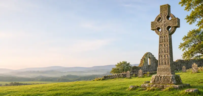
On a low mound in a field c. 120m E of Dysert O’Dea Romanesque church (CL025-091001-). This is the high cross of St. Tola, traditionally the founder of the monastic site, listed in the SMR (1992) and the RMP (1996) as ‘Cross’ and sometimes known as the ‘White cross of Tola’.
Full archaeological record 611 words
On a low mound in a field c. 120m E of Dysert O’Dea Romanesque church (CL025-091001-). This is the high cross of St. Tola, traditionally the founder of the monastic site, listed in the SMR (1992) and the RMP (1996) as ‘Cross’ and sometimes known as the ‘White cross of Tola’. Described by Harbison (1992, 83-6) as a Romanesque limestone cross (H 2.77m to the top of the head, without the modern capstone; Wth 1.02m across the arms; tapering shaft 0.65m x 0.37m at lower end) with a decorated base (H 0.5m; 1.28m x 1.02m), mounted on large squared decorated stones that may have formed part of an altar presumably from the nearby church. This in turn sits on a projecting modern base topped with flat flags. The cross was repaired in 1683 by Michael O’Dea and re-erected by F.H. Synge in 1871 as outlined in an inscription on the base of the E side (the bottom of the frame was cut away to allow for the inscription). The shaft is in two portions that do not fit well together. The great difference in the height of the relief between the two main figures and the variation in outlines, mouldings and ornament suggest the possibility of two different crosses although Harbison (ibid., 83) notes they are likely to be products of the same workshop and may have fitted together in the 12th century. The head of the cross has no ring and its corners are roll moulded with smaller ribs inside. Mortice-holes at the end of each arm suggest some sort of attachment.
E FACE: The head of the E face shows the crucified Christ in high relief with outstretched arms. Christ’s head was fixed in position in 1883 and may not have belonged to the cross originally. The lower portion of the E face shows a bishop or abbot with pointed mitre and a crozier in the left hand, again in high relief. The right hand is missing and may originally have been inserted into a hole present at waist height. The base of the E face has a panel of interlace. The bottom of the panel was cut away for the following inscription: THIS CROSS WAS NEWLY REPAIRED BY MICHAEL O DEA SON OF CONNOR CRONE O DEA IN THE YEARE 1683.
S FACE: The upper portion has an interlinking meander pattern. The lower cross shaft has three panels of interlaced animals. The base shows Daniel in the Lion’s Den and the following inscription: REERECTED BY FRANCIS HUTCHINSON SYNGE OF DYSART FOURTH SON OF THE LATE SIR EDWARD SYNGE BAR AND MARY HELENA HIS WIFE IN THE YEAR 1871.
W FACE: The head of the W face has a St. Brigid’s cross consisting of five lozenges in relief and the S arm has two animals grasping a sphere in their jaws beneath which is a panel forming the motif of a cross with expanded terminals. The lower portion of the shaft has four panels of decoration, three with animal interlace and one with sunken crosses. The base of the W face shows Adam and Eve.
N FACE: The Upper portion of the N face has a fret pattern and the cross shaft below this has three panels of animal interlacing. The base on this side shows an unidentified scene with two figures grasping a staff with a figure on the left holding a crook and another figure on the right who may also have held a staff.
This is a national monument in State care. St. Tola’s holy well lies c. 240m to SE. (Westropp 1894; 156-8; Harbison 1992, vol. 1, 83-6; Swinfen 1992, 23; Ó Murchadha 1993, 36-42;).
Archaeological Survey of Ireland, National Monuments Service (CC BY 4.0) · Compiled by Mary Tunney · Updated 27 September 2017. It describes the site as it was when surveyed.
Folklore and traditions
This is the high cross of St. Tola, traditionally the founder of the monastic site, listed in the SMR (1992) and the RMP (1996) as ‘Cross’ and sometimes known as the ‘White cross of Tola’.
More high crosses nearby
 National Monument
North Cross, Kilfenora
Cross - High cross · Kilfenora · Clare · 14 km away
 National Monument
Doorty's Cross, Kilfenora
Cross - High cross · Kilfenora · Clare · 14 km away
 National Monument
Kilfenora Cathedral and Crosses
Cross - High cross · Kilfenora · Clare · 14 km away
 National Monument
South Cross, Kilfenora
Cross - High cross · Kilfenora · Clare · 14 km away
Also recorded nearby
Named sites within 5 km with only a short entry in the Archaeological Survey.
- Rath Round TowerRound tower · Rath · 1.6 km · official record
- ToberinneenboyRitual site - holy well · Caherbannagh · 2.8 km · official record
Visitors' notes
Badges are opinions of visitors - not verified facts. One vote per badge and visitor; no account needed.
Best time to visit
What's missing on this page?
Share a tip to find it
Share a local tradition or story
Suggest a correction
Suggest the right map location
Report a duplicate page
Ask a question
Do not include personal data. See our privacy notice.
Around Mollaneen High Cross
Other heritage nearby
- Dysert O'Dea monastic siteAncient church · 0.1 km
- Dysert O'Dea round towerRound tower · 0.1 km
- Dysert O'Dea Castle & Clare Archaeology CentreCastle · 0.2 km
- ToberinneenboyHoly well · 4.8 km
- ToberinneenboyHoly well · 5.0 km
- ToberinneenboyHoly well · 5.4 km
Recorded within 5 km
- 122 ringfortsArchaeological Survey of Ireland
- 15 castlesArchaeological Survey of Ireland
- 10 holy wellsArchaeological Survey of Ireland
- 9 ancient churchesArchaeological Survey of Ireland
- 5 megalithic tombsArchaeological Survey of Ireland
- 2 round towersArchaeological Survey of Ireland
- 1 monastic siteArchaeological Survey of Ireland
- 1 standing stoneArchaeological Survey of Ireland
Walks and trails
- Burren WayLong Distance Waymarked Way · 118.8 km · nearest point 3.6 km
- Mid Clare Way - Slí na MearacaunLong Distance Waymarked Way · 142.9 km · nearest point 4.2 km
- Ruan - Dromore Wood loopWalking Trail · 6.4 km · nearest point 6.5 km
Outdoors, towns and places to stay
- Ballyallia Lake, EnnisBeaches · 7.5 km · Excellent Quality (2025)
- LahinchBeaches · 19 km · Good Quality (2025)
- Dromore Nature ReserveNature reserves · 7.7 km
- Ballyteigue Nature ReserveNature reserves · 19 km
- Inchiquin HouseHistoric stays · 5.7 km
- Newpark HouseHistoric stays · 9.6 km
Other attractions nearby
- Nordic Fitness IrelandWalking · 1.2 km
- Walk with PiusNature and Wildlife · 3.9 km
- Burren Experience Guided WalksNature and Wildlife · 3.9 km
- Kilnaboy Medieval Church and Round TowerHistoric Houses and Castle · 7.0 km
What's on nearby
- Traditional Music of Europe2026-11-08 · 9.4 km · free
- Romeo & Juliet, Ballet Ireland2026-11-24 · 9.4 km
Excavations nearby
- 04E0026 Claureen Site AR131, County ClareRoad-scheme excavation report (TII) · 8.0 km