


Unofficial guide. Not the National Monuments Service, the OPW, Fáilte Ireland or the landowner. Disclaimer
At a glance
- TypeCross - High cross
- Date or period mentioned8th-century
- Recorded sizeH 3.65m; W 1.39m
- StatusNational Monument
What to look for
- Carved scenes
- Base
Picked out from the Archaeological Survey description below.
Can you visit?
- No source says it is open to the public.Most monuments in Ireland stand on private farmland.
- Ask the landowner before crossing fields, close gates, leave the stones as you find them.Visiting responsibly
History and description
On an E-facing slope in undulating hilly terrain. A high cross, of sandstone, is centrally placed within a square graveyard (TS079-007005-) defined by a stone wall.
Full archaeological record 212 words
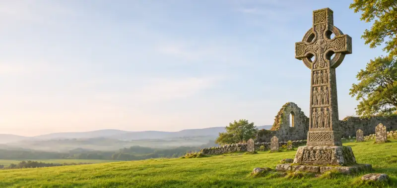
On an E-facing slope in undulating hilly terrain. A high cross, of sandstone, is centrally placed within a square graveyard (TS079-007005-) defined by a stone wall. A later medieval church (TS079-007001-) is located c. 30m to the N. Another high cross (TS079-007003-) is located to the S and a cross base (TS079-007004-) to the SE. The N cross (H 3.65m; Wth 1.39m) is of the ringed high cross type with a conical capstone. The cross itself is decorated with ornamental designs which are paralleled in 8th-century metalwork (Richardson and Scarry 1990, 29). The stepped base (1.23m x 1.05m; H 0.66m) is decorated with figured scenes on all four sides. The N side depicts a procession with chariot; the E side Adam naming the animals; the S side a funeral procession, an ecclesiastic with a ringed processional cross walks in front of a horse bearing a headless body, ravens attack the corpse and at the rear a man carries the head; the W side depicts seven cloaked figures carrying staffs or croziers and has been interpreted as seven bishops or the mission of the apostles (ibid.; Hickey 1955, 118-21). The high cross is part of a group of crosses identified with the former medieval kingdom of Ossory (Crawford 1909, 256-60; Edwards 1983, 5-46).
Archaeological Survey of Ireland, National Monuments Service (CC BY 4.0) · Compiled by Jean Farrelly · Updated 26 August 2011. It describes the site as it was when surveyed.
More high crosses nearby
 National Monument
Kilkieran High Crosses
Cross - High cross · Castletown (Iverk By) · Kilkenny · 1.8 km away
 National Monument
Killamery High Cross
Cross - High cross · Killamery · Kilkenny · 7.8 km away

Kilree High Cross
Cross - High cross · Kilree (Kells By.) · Kilkenny · 14 km away
Leggetsrath East High Cross
Cross - High cross · Leggetsrath East · Kilkenny · 29 km away
Also recorded nearby
Named sites within 5 km with only a short entry in the Archaeological Survey.
- Well of the VirginRitual site - holy well · Kilmacoliver · 2.1 km · official record
- Knockroe holy wellRitual site - holy well · Knockroe (Kells By., Killamery Ed) · 2.2 km · official record
- TobernarahaRitual site - holy well · Knockroe (Kells By., Killamery Ed) · 2.4 km · official record
- TobernamonineRitual site - holy well · Glencommaun · 2.8 km · official record
- St. Mocuille's WellRitual site - holy well · Glencommaun · 2.9 km · official record
- Church WellRitual site - holy well · Oldcastle Lower · 3.3 km · official record
- TobernagloghlinRitual site - holy well · Kiltrassy · 3.3 km · official record
- St. Bridget’s WellRitual site - holy well · Lamoge · 4.2 km · official record
Visitors' notes
Badges are opinions of visitors - not verified facts. One vote per badge and visitor; no account needed.
Best time to visit
What's missing on this page?
Share a tip to find it
Share a local tradition or story
Suggest a correction
Suggest the right map location
Report a duplicate page
Ask a question
Do not include personal data. See our privacy notice.
Around Ahenny High Crosses
Other heritage nearby
- St. Crispin's Church (ruin)Ancient church · 0.0 km
- Castletown ChurchAncient church · 1.9 km
- St. Kieran’s WellHoly well · 1.9 km
- Knockroe Passage TombMegalithic tomb · 2.2 km
- Owning Portal TombMegalithic tomb · 4.3 km
- Ballinvir Standing StoneStanding stone · 4.9 km
Recorded within 5 km
- 18 ringfortsArchaeological Survey of Ireland
- 11 holy wellsArchaeological Survey of Ireland
- 10 ancient churchesArchaeological Survey of Ireland
- 7 castlesArchaeological Survey of Ireland
- 6 high crossesArchaeological Survey of Ireland
- 6 standing stonesArchaeological Survey of Ireland
- 6 megalithic tombsArchaeological Survey of Ireland
- 2 hillfortsArchaeological Survey of Ireland
- 2 ogham stonesArchaeological Survey of Ireland
- 1 monastic siteArchaeological Survey of Ireland
Walks and trails
- Tullahought - Kilmacoliver Summit LoopWalking Trail · 3.8 km · nearest point 1.6 km
- Tullahought - Kilmacoliver Woodland LoopWalking Trail · 2.1 km · nearest point 1.6 km
- Windgap - Bearna Breac LoopWalking Trail · 6.6 km · nearest point 5.3 km
Outdoors, towns and places to stay
- CastlemorrisForests · 8.7 km
- Garryricken Nature ReserveNature reserves · 9.5 km
- Fiddown Island Nature ReserveNature reserves · 11 km
- Carrick-on-SuirWalled towns · 7.6 km
- CallanWalled towns · 15 km
Other attractions nearby
- Kilkieran High CrossAbbeys and Monastery · 1.8 km
- Knockroe Passage TombHistoric Houses and Castle · 2.2 km
- Walk With WalterWalking · 6.7 km
- Ormond CastleHistoric Houses and Castle · 7.5 km