
Unofficial guide. Not the National Monuments Service, the OPW, Fáilte Ireland or the landowner. Disclaimer
At a glance
- TypeStone circle - five-stone
What to look for
- Stones still standing
- Alignment
Picked out from the Archaeological Survey description below.
Can you visit?
- No source says it is open to the public.Most monuments in Ireland stand on private farmland.
- Ask the landowner before crossing fields, close gates, leave the stones as you find them.Visiting responsibly
History and description
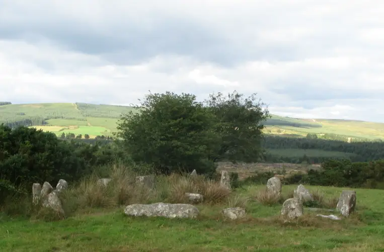
On shoulder of S-facing hill slope, N of Glashagloragh river. Circle complete; N entrance stone has fallen; interior filled with field stones.
Full archaeological record 56 words
On shoulder of S-facing hill slope, N of Glashagloragh river. Circle complete; N entrance stone has fallen; interior filled with field stones. Orthostats are 0.7m to 1.7m L, 0.15m to 0.6m T and 1m to 1.4m H. Internal measurement along main axis, aligned NE-SW, is 2.7m. (O Nualláin 1984, 44, no. 89; Roberts 1988, no. 9)
Archaeological Survey of Ireland, National Monuments Service (CC BY 4.0) · Updated 14 January 2009 · Based on the Archaeological Inventory of County Cork. Volume 1: West Cork. It describes the site as it was when surveyed.
More stone circles nearby
Drombeg Stone Circle
Stone circle - multiple-stone · Drombeg (Carbery E. (W.D.) By.) · Cork · 11 km away
National MonumentDerryarkane Stone Circle
Stone circle - five-stone · Derryarkane · Cork · 22 km away
Visitors' notes
Badges are opinions of visitors - not verified facts. One vote per badge and visitor; no account needed.
Best time to visit
What's missing on this page?
Share a tip to find it
Share a local tradition or story
Suggest a correction
Suggest the right map location
Report a duplicate page
Ask a question
Do not include personal data. See our privacy notice.
Around Knockawaddra stone circle
Other heritage nearby
- Ballinacarriga CastleCastle · 5.8 km
- Coppinger's CourtCastle · 9.7 km
Recorded within 5 km
- 44 ringfortsArchaeological Survey of Ireland
- 19 standing stonesArchaeological Survey of Ireland
- 8 stone circlesArchaeological Survey of Ireland
- 3 ancient churchesArchaeological Survey of Ireland
- 2 holy wellsArchaeological Survey of Ireland
- 1 megalithic tombArchaeological Survey of Ireland
- 1 monastic siteArchaeological Survey of Ireland
Walks and trails
- Carrigfadda - Carrigfadda Hill WalkWalking Trail · 2.5 km · nearest point 3.0 km
- Cellmount LoopWalking Trail · 1.5 km · nearest point 7.5 km
- Yew Tree Hill Loop WalkWalking Trail · 7.0 km · nearest point 7.7 km
Outdoors, towns and places to stay
- CarrigfaddaForests · 3.3 km
- DromillihyForests · 7.7 km
- Warren, Cregane StrandBeaches · 11 km · Good Quality (2025)
- Owenahincha, Little Island StrandBeaches · 12 km · Excellent Quality (2025)
- RosscarberyWalled towns · 9.3 km
- Galley Head Lightkeeper's House 1Historic stays · 16 km
- Galley Head Lightkeeper's House 2Historic stays · 16 km
Other attractions nearby
- Ballynacarriga CastleHistoric Houses and Castle · 5.8 km
- Michael Collins BirthplaceHistoric Houses and Castle · 7.6 km
- Sam Maguire Visitor ExperienceMuseums and Attraction · 7.7 km
- Sam Maguire Passport TrailWalking · 7.7 km