
Unofficial guide. Not the National Monuments Service, the OPW, Fáilte Ireland or the landowner. Disclaimer
At a glance
- TypeStanding stone
- Recorded sizeH 1.4m; 0.87m x 0.62m
- StatusNational Monument
What to look for
- Packing stones
Picked out from the Archaeological Survey description below.
Can you visit?
- No source says it is open to the public.Most monuments in Ireland stand on private farmland.
- Ask the landowner before crossing fields, close gates, leave the stones as you find them.Visiting responsibly
History and description
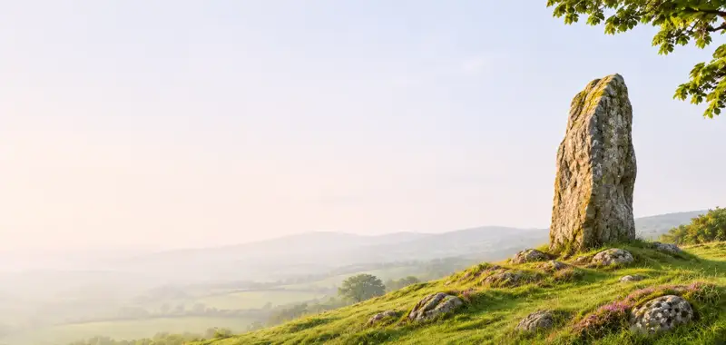
National Monument No. 353. Situated on the W-facing lower slope of a hill overlooking a valley, in a field NW of the 'Timoney Stones' (TN018-015001-).
Full archaeological record 100 words
National Monument No. 353. Situated on the W-facing lower slope of a hill overlooking a valley, in a field NW of the 'Timoney Stones' (TN018-015001-). Not indicated on the 1st (1843) or 2nd (1904) ed. OS 6-inch map. The stone (H 1.4m; dims. 0.87m x 0.62m), composed of sandstone with quartz pebble inclusions, is aligned NNE-SSW, rising to its apex at NNE. It is rectangular in plan. A seam of white quartz is exposed on the top surface of the stone. A small stone projects from the base at the NNE side, which may be evidence of a packing stone.
References
- Compiled and revised by: Caimin O'Brien and Jean Farrelly
Archaeological Survey of Ireland, National Monuments Service (CC BY 4.0) · Updated 06 February 2015 · Based on the The Archaeological Inventory of County Tipperary. Vol. 1 - North Tipperary' compiled by Jean Farrelly and Caimin O'Brien. It describes the site as it was when surveyed.
Visitors' notes
Badges are opinions of visitors - not verified facts. One vote per badge and visitor; no account needed.
Best time to visit
What's missing on this page?
Share a tip to find it
Share a local tradition or story
Suggest a correction
Suggest the right map location
Report a duplicate page
Ask a question
Do not include personal data. See our privacy notice.
Around Timoney Stones
Other heritage nearby
- Monaincha ChurchAncient church · 4.9 km
- Monaincha High CrossHigh cross · 4.9 km
- Ballaghmore CastleCastle · 6.3 km
- St. Kieran's ChurchAncient church · 6.7 km
- Roscrea FriaryAbbey or friary · 7.3 km
- Roscrea ChurchAncient church · 7.4 km
Recorded within 5 km
- 220 standing stonesArchaeological Survey of Ireland
- 9 ringfortsArchaeological Survey of Ireland
- 7 ancient churchesArchaeological Survey of Ireland
- 5 castlesArchaeological Survey of Ireland
- 2 monastic sitesArchaeological Survey of Ireland
- 2 high crossesArchaeological Survey of Ireland
- 1 megalithic tombArchaeological Survey of Ireland
- 1 holy wellArchaeological Survey of Ireland
Walks and trails
- The Source of the Nore Walking TrailWalking Trail · 2.6 km · nearest point 5.6 km
- Birr Cycle Hub Loop 4 ARoad Cycling Trail · 40.1 km · nearest point 10.0 km
- Birr Cycle Hub Loop 4Road Cycling Trail · 47.0 km · nearest point 12 km
Outdoors, towns and places to stay
- Golden GroveForests · 10 km
- Glasderry WoodForests · 14 km
- Coolacurragh Wood Nature ReserveNature reserves · 15 km
- Grantstown Wood and Grantstown Lough Nature ReserveNature reserves · 16 km
- Roundwood HouseHistoric stays · 19 km
Other attractions nearby
- Roscrea Heritage Centre – Roscrea Castle and Damer HouseHistoric Houses and Castle · 7.4 km
- St. Crónán's High Cross at Black MillsHistoric Houses and Castle · 7.4 km
- Roscrea Castle and Damer HouseHistoric Houses and Castle · 7.4 km
- Climb Ireland - ToursNature and Wildlife · 7.5 km
Excavations nearby
- E3742 Tinderry 2, County TipperaryRoad-scheme excavation report (TII) · 1.8 km
- E3743 Tinderry 1 , County TipperaryRoad-scheme excavation report (TII) · 1.8 km