


Unofficial guide. Not the National Monuments Service, the OPW, Fáilte Ireland or the landowner. Disclaimer
At a glance
- TypeStanding stone
- Date or period mentioned19th century
What to look for
- Standing upright
Picked out from the Archaeological Survey description below.
Can you visit?
- No source says it is open to the public.Most monuments in Ireland stand on private farmland.
- Ask the landowner before crossing fields, close gates, leave the stones as you find them.Visiting responsibly
History and description
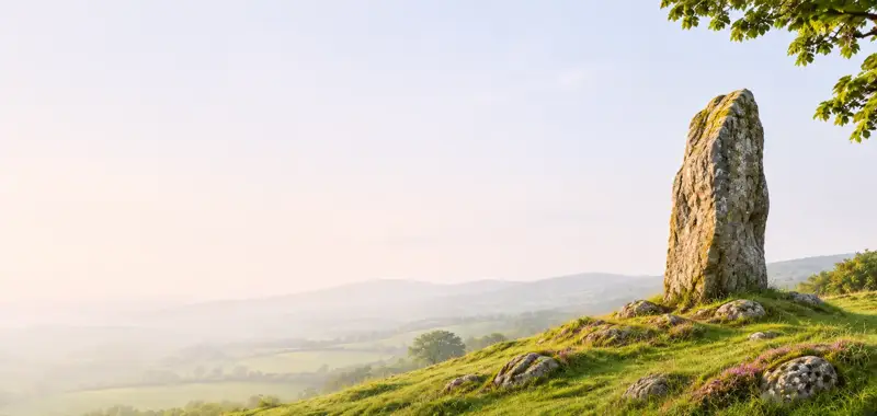
Located on level ground at the E end of the Sea Hill ridge, this stone has split vertically into 2 separate slabs. The greater portion remains standing and is 3.75m high and c. 2.6m x .7m at base; NE-SW. A large slab, 3m high, 2.2m wide and c. 0.15m thick, has become detached from the NW face and rests at a 45 degrees angle, supported by 2 low uprights, neither of which appears to be socketed in the ground.
Full archaeological record 101 words
Located on level ground at the E end of the Sea Hill ridge, this stone has split vertically into 2 separate slabs. The greater portion remains standing and is 3.75m high and c. 2.6m x .7m at base; NE-SW. A large slab, 3m high, 2.2m wide and c. 0.15m thick, has become detached from the NW face and rests at a 45 degrees angle, supported by 2 low uprights, neither of which appears to be socketed in the ground. These latter stand .9m and 1.1m high. The stone appears to have been intact in the early 19th century (OSNB Minard, 31).
Archaeological Survey of Ireland, National Monuments Service (CC BY 4.0) · Updated 4 August 2013 · Based on the J. Cuppage, ‘Corca Dhuibhne. Dingle Peninsula archaeological survey. Ballyferriter. Oidhreacht Chorca Dhuibhne. It describes the site as it was when surveyed.
Visitors' notes
Badges are opinions of visitors - not verified facts. One vote per badge and visitor; no account needed.
Best time to visit
What's missing on this page?
Share a tip to find it
Share a local tradition or story
Suggest a correction
Suggest the right map location
Report a duplicate page
Ask a question
Do not include personal data. See our privacy notice.
Around Graigue Standing Stone
Other heritage nearby
- Cnoc na Fola ogham stonesOgham stone · 1.0 km
- Doonmanagh Wedge tombMegalithic tomb · 1.2 km
- St Johns Well - Tobar EoinHoly well · 2.6 km
- Minard CastleCastle · 2.6 km
- TobermurryHoly well · 4.1 km
- ToberaroonHoly well · 6.1 km
Recorded within 5 km
- 90 ringfortsArchaeological Survey of Ireland
- 18 standing stonesArchaeological Survey of Ireland
- 12 ogham stonesArchaeological Survey of Ireland
- 9 holy wellsArchaeological Survey of Ireland
- 7 ancient churchesArchaeological Survey of Ireland
- 5 promontory fortsArchaeological Survey of Ireland
- 3 megalithic tombsArchaeological Survey of Ireland
- 3 monastic sitesArchaeological Survey of Ireland
- 1 castleArchaeological Survey of Ireland
Walks and trails
- Dingle WayLong Distance Waymarked Way · 163.0 km · nearest point 1.2 km
- Meelin Hill Looped Walk /Lúbshiúlóid na MaoilinneWalking Trail · 7.8 km · nearest point 6.3 km
- Siúlóid na nGleanntaWalking Trail · 2.3 km · nearest point 9.8 km
Outdoors, towns and places to stay
- GlanteenassigForests · 12 km
- InchBeaches · 11 km · Excellent Quality (2025)
- KellsBeaches · 13 km · Excellent Quality (2025)
- Castlemaine Harbour Nature ReserveNature reserves · 14 km
- Mount Brandon Nature ReserveNature reserves · 16 km
- DingleWalled towns · 8.3 km
Other attractions nearby
- Minard CastleHistoric Houses and Castle · 2.6 km
- Kinard BeachNatural Landscape · 4.5 km
- Doonshean BeachNature and Wildlife · 5.1 km
- An Chonair (Conor Pass)Natural Landscape · 6.6 km
What's on nearby
- Dingle Literary Festival 20262026-11-20 · 8.6 km
- Dingle Literary Festival 20262026-11-21 · 8.6 km
- Dingle Literary Festival 20262026-11-22 · 8.6 km