


Unofficial guide. Not the National Monuments Service, the OPW, Fáilte Ireland or the landowner. Disclaimer
At a glance
- TypeCross - High cross
- Recorded sizeH 1.88m; W across arms 1.1m; W of bottom of shaft 0.32m
- StatusNational Monument
What to look for
- Base
Picked out from the Archaeological Survey description below.
Can you visit?
- No source says it is open to the public.Most monuments in Ireland stand on private farmland.
- Ask the landowner before crossing fields, close gates, leave the stones as you find them.Visiting responsibly
History and description
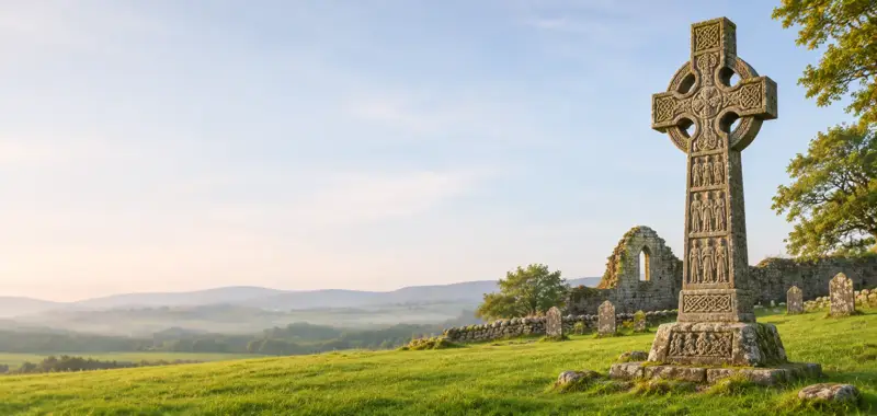
National Monument No. 352. To N of present graveyard is well-preserved solid-wheeled cross with central boss and rope mouldings on each face (H 1.88m; Wth across arms 1.1m; Wth of bottom of shaft 0.32m).
Full archaeological record 51 words
National Monument No. 352. To N of present graveyard is well-preserved solid-wheeled cross with central boss and rope mouldings on each face (H 1.88m; Wth across arms 1.1m; Wth of bottom of shaft 0.32m). It is placed in a pyramidal base (H0.6m; L 1.25m; Wth 1.1m). (Harbison 1992, 158 (entry 186)).
Archaeological Survey of Ireland, National Monuments Service (CC BY 4.0) · Compiled by Claire Breen · Updated 19 August 2011. It describes the site as it was when surveyed.
More high crosses nearby
 National Monument
Lorum High Cross
Cross - High cross · Lorum · Carlow · 9.9 km away
 National Monument
Ullard high cross
Cross - High cross · Ullard · Kilkenny · 19 km away
Leggetsrath East High Cross
Cross - High cross · Leggetsrath East · Kilkenny · 23 km away
 National Monument
Moone High Cross
Cross - High cross · Moone · Kildare · 26 km away
Visitors' notes
Badges are opinions of visitors - not verified facts. One vote per badge and visitor; no account needed.
Best time to visit
What's missing on this page?
Share a tip to find it
Share a local tradition or story
Suggest a correction
Suggest the right map location
Report a duplicate page
Ask a question
Do not include personal data. See our privacy notice.
Around Nurney Cross
Other heritage nearby
- St Bridget's WellHoly well · 4.7 km
- Leighlinbridge CastleCastle · 4.7 km
- Ballyknockan ChurchAncient church · 5.1 km
- St Patrick's WellHoly well · 5.3 km
- Ballymoon CastleCastle · 5.8 km
- Kellistown Round TowerRound tower · 7.0 km
Recorded within 5 km
- 11 ringfortsArchaeological Survey of Ireland
- 10 ancient churchesArchaeological Survey of Ireland
- 9 castlesArchaeological Survey of Ireland
- 3 high crossesArchaeological Survey of Ireland
- 3 holy wellsArchaeological Survey of Ireland
- 1 monastic siteArchaeological Survey of Ireland
- 1 standing stoneArchaeological Survey of Ireland
- 1 abbey or friaryArchaeological Survey of Ireland
Walks and trails
- The Columban Way - Nine Stones to MaganyPilgrim Path · 50.2 km · nearest point 3.6 km
- Clogrennane Wood LoopWalking Trail · 2.4 km · nearest point 7.1 km
- Oak Park LoopWalking Trail · 3.7 km · nearest point 13 km
Outdoors, towns and places to stay
- ClogrennanForests · 7.1 km
- LeighlinbridgeWalled towns · 4.7 km
- Old LeighlinWalled towns · 7.7 km
Other attractions nearby
- Black CastleHistoric Houses and Castle · 4.7 km
- Leighlinbridge - Garden VillageGardens · 5.1 km
- Ballymoon CastleHistoric Houses and Castle · 5.8 km
- St Laserian's CathedralAbbeys and Monastery · 7.8 km
What's on nearby
- Derek Ryan - Songwriter Show2026-11-08 · 9.6 km
- Autumn / Winter Cinemas at VISUAL2026-12-22 · 9.6 km