


Unofficial guide. Not the National Monuments Service, the OPW, Fáilte Ireland or the landowner. Disclaimer
At a glance
- TypeStanding stone
What to look for
- Standing upright
Picked out from the Archaeological Survey description below.
Can you visit?
- No source says it is open to the public.Most monuments in Ireland stand on private farmland.
- Ask the landowner before crossing fields, close gates, leave the stones as you find them.Visiting responsibly
History and description
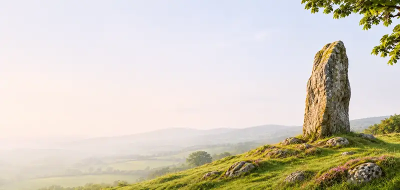
A standing stone 2.95m in height, rectangular in plan 1.35m × 0.78m, orientated N-S. The stone is located on flat pasture land to the S of the Owenea river.
Full archaeological record 135 words
A standing stone 2.95m in height, rectangular in plan 1.35m × 0.78m, orientated N-S. The stone is located on flat pasture land to the S of the Owenea river. Described by Dr. Pococke in 1752 as 'a bridge over the river Oneck [Owenea], where there is a stone set up an end nine feet [2.95m] high, four [1.2m] broad and three [0.91m] thick, they call it Fin McCoues shoulder stone, with which he used to divert himself by throwing it like a Quoit' (Stokes 1891, 67-8).
Trial-trenching was carried out by Anne Carey under licence No. 07E0195 on the outskirts of the village of Ardara on 24 February 2007, in advance of a proposed housing development. Six trial-trenches were excavated at the site (NGR 163680/391970) and nothing of archaeological significance was recovered (Bennett 2010, 75).
Archaeological Survey of Ireland, National Monuments Service (CC BY 4.0) · Compiled by Brian Lacey with Eamon Cody, Claire Cotter, Judy Cuppage, Noel Dunne, Vincent Hurley, Celie O'Rahilly, Paul Walsh and Seán Ó Nualláin (Lifford: Donegal County Council, 1983). In certain instances the entries have been revised and updated · Updated 15 November 2011. It describes the site as it was when surveyed.
Visitors' notes
Badges are opinions of visitors - not verified facts. One vote per badge and visitor; no account needed.
Best time to visit
What's missing on this page?
Share a tip to find it
Share a local tradition or story
Suggest a correction
Suggest the right map location
Report a duplicate page
Ask a question
Do not include personal data. See our privacy notice.
Around Owenea Stone
Other heritage nearby
- Portal tomb Dg. 70, Kilclooney MoreMegalithic tomb · 5.0 km
- Priest Boyle's WellHoly well · 8.7 km
Recorded within 5 km
- 15 ringfortsArchaeological Survey of Ireland
- 7 megalithic tombsArchaeological Survey of Ireland
- 3 standing stonesArchaeological Survey of Ireland
- 3 holy wellsArchaeological Survey of Ireland
- 2 monastic sitesArchaeological Survey of Ireland
- 2 ancient churchesArchaeological Survey of Ireland
Walks and trails
- Slí Cholmcille - Sli Dhun na nGallLong Distance Waymarked Way · 65.3 km · nearest point 1.5 km
- Bonny Glen Wood - Lough Namanlagh trailWalking Trail · 1.5 km · nearest point 6.1 km
- Bonny Glen Wood - Bonny Glen walkWalking Trail · 1.0 km · nearest point 6.3 km
Outdoors, towns and places to stay
- Bonny Glen WoodForests · 6.4 km
- NaranBeaches · 7.8 km · Excellent Quality (2025)
- DooeyBeaches · 11 km · Excellent Quality (2025)
- Derkmore Wood Nature ReserveNature reserves · 10 km
- Termon HouseHistoric stays · 18 km
- St Johns Point LighthouseHistoric stays · 23 km
Other attractions nearby
- Malaidh Ghleann Gheis (Glengesh Pass)Natural Landscape · 7.7 km