
Unofficial guide. Not the National Monuments Service, the OPW, Fáilte Ireland or the landowner. Disclaimer
At a glance
- TypeOgham stone
- Recorded sizeL 1.9m; W 0.55m; T 0.35m
- StatusNational Monument
What to look for
- Ogham inscription
Picked out from the Archaeological Survey description below.
Can you visit?
- No source says it is open to the public.Most monuments in Ireland stand on private farmland.
- Ask the landowner before crossing fields, close gates, leave the stones as you find them.Visiting responsibly
History and description
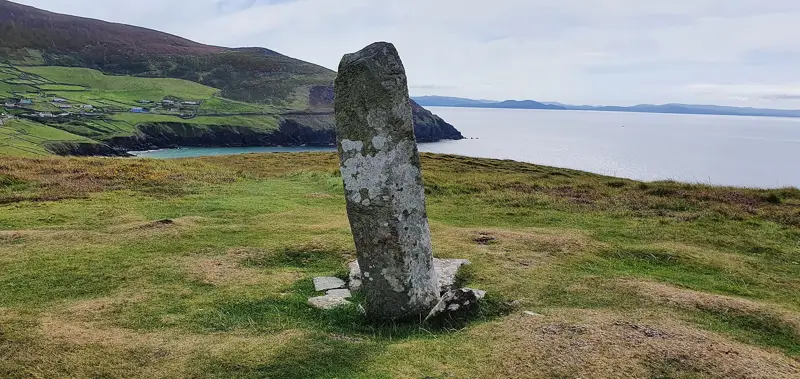
In 1985 while cleaning scrub this second ogham stone at the site was discovered protruding from the bank of the rath (RO015-051002-), and subsequently became dislodged. It is a sandstone monolith (L 1.9m; Wth 0.55m; T 0.35m).
Full archaeological record 151 words
In 1985 while cleaning scrub this second ogham stone at the site was discovered protruding from the bank of the rath (RO015-051002-), and subsequently became dislodged. It is a sandstone monolith (L 1.9m; Wth 0.55m; T 0.35m). The right-hand angle was visible in 1985 and the inscription ran unusually up this angle. It was read at the time by F. Moore as: RAVASA KOI MAQQI DO....U, but none of the left-hand angle could be read (SMR file). The stone is now lying on the ground outside the rath at the SW. Ogham stone (RO015-051001-) and standing stone (RO015-051003-) are c. 5m to the NE, inside the rath.
This is a National Monument in state ownership: No. 650
This stone has been studied as part of the ‘Ogham in 3D’ project undertaken by the School of Celtic Studies, Dublin Institute for Advanced Studies. To access details go to the following website: https://ogham.celt.dias.ie/search.php?ciic=Drummin_II
Archaeological Survey of Ireland, National Monuments Service (CC BY 4.0) · Compiled by Nora White · Updated 26 September 2016. It describes the site as it was when surveyed.
Visitors' notes
Badges are opinions of visitors - not verified facts. One vote per badge and visitor; no account needed.
Best time to visit
What's missing on this page?
Share a tip to find it
Share a local tradition or story
Suggest a correction
Suggest the right map location
Report a duplicate page
Ask a question
Do not include personal data. See our privacy notice.
Around Drummin Ogham Stones
Other heritage nearby
- Cloonshanville High CrossHigh cross · 3.9 km
- ToberbreediaHoly well · 7.0 km
- ToberelvaHoly well · 8.8 km
- Tober CaelainnHoly well · 8.9 km
- CarrowgarveHillfort · 9.5 km
Recorded within 5 km
- 32 ringfortsArchaeological Survey of Ireland
- 5 standing stonesArchaeological Survey of Ireland
- 4 ancient churchesArchaeological Survey of Ireland
- 3 monastic sitesArchaeological Survey of Ireland
- 2 castlesArchaeological Survey of Ireland
- 2 holy wellsArchaeological Survey of Ireland
- 1 ogham stoneArchaeological Survey of Ireland
- 1 megalithic tombArchaeological Survey of Ireland
- 1 high crossArchaeological Survey of Ireland
- 1 abbey or friaryArchaeological Survey of Ireland
Walks and trails
- Rathcroghan Looped Archaeological TrailWalking Trail · 11.5 km · nearest point 5.5 km
- Lung Lough Gara WayLong Distance Waymarked Way · 60.0 km · nearest point 7.9 km
- Tarmon Bog WalkWalking Trail · 5.3 km · nearest point 8.4 km
Other attractions nearby
- Douglas Hyde Interpretative CentreMuseums and Attraction · 7.5 km
- Elphin WindmillMuseums and Attraction · 11 km
- Castlerea Railway MuseumMuseums and Attraction · 11 km
- Clonalis HouseHistoric Houses and Castle · 11 km
What's on nearby
- Halloween at Rathcroghan: Origins of Samhain Tour2026-11-05 · 9.8 km
- Halloween at Rathcroghan: Origins of Samhain Tour2026-11-06 · 9.8 km
- The Pale Blue Dot2026-11-13 · 16 km