


Unofficial guide. Not the National Monuments Service, the OPW, Fáilte Ireland or the landowner. Disclaimer
At a glance
- TypeEcclesiastical enclosure
- Date or period mentioned7th century
- Recorded sizediameter 35.4m NE-SW; 26m NW-SE
- StatusNational Monument
Picked out from the Archaeological Survey description below.
Can you visit?
- No source says it is open to the public.Most monuments in Ireland stand on private farmland.
- Ask the landowner before crossing fields, close gates, leave the stones as you find them.Visiting responsibly
History and description
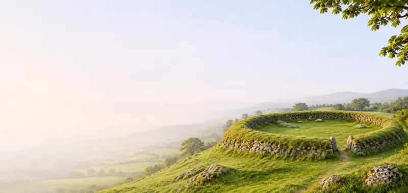
On a gentle N-facing slope in a small wooded area surrounded by marsh and rough meadow, in the Glen of Aherlow at the foot of the Galty mountains. St. Berrihert's Well is located c. 170m to SE. It is named after St. Berichter, a Saxon saint, founder of Tullylease, Co.Cork who came to Ireland in the late 7th century (Ó hÉailidhe 1967, 104).
Full archaeological record 549 words
On a gentle N-facing slope in a small wooded area surrounded by marsh and rough meadow, in the Glen of Aherlow at the foot of the Galty mountains. St. Berrihert's Well is located c. 170m to SE. It is named after St. Berichter, a Saxon saint, founder of Tullylease, Co.Cork who came to Ireland in the late 7th century (Ó hÉailidhe 1967, 104). The saint's pattern day is on the 18th of February and prayers were said at the Kyle and the well (Ó hÉailidhe 1967, 105). Oval area (diam. 35.4m NE-SW; 26m NW-SE) defined by an earth and stone bank (Wth 2.45-3.3m; int. H 0.31-0.66m; ext. H 1.08m) which is referred to locally as the Kyle (Ó hÉailidhe 1967, 103). In S sector of enclosure there is a modern oval construction (int. dims. 5.5m x 9.5m) of mortared stone (wall T 1.1m), quite a crude structure built by the OPW in 1946 (ibid., 102) to display the cross-slabs and protect them from cattle damage. This modern enclosure is accessed by a style with steps in the W quadrant, the outer steps have partially collapsed and include a re-used stone with a deliberate groove. At the same time the larger enclosure was defined by kerb stones and a number of small heaps of stone, each surmounted by a cross-inscribed slab, was erected at intervals on the bank (ibid. 103). These constructions, however, never formed part of the annual devotions (ibid., 103). In the centre of the interior there are a number of small upright stones which mark the burial places of unbaptised infants (ibid., 103).
According to Ó hÉailidhe (103) there were seventy-two slabs (TS074-010008- to TS074-010078-) identified. There is also the head of a high-cross (TS074-010003-), the base of a cross with a bullaun-like depression (TS074-010004-), another cross-base (TS074-010080-) and fragment of a quernstone. Of the church (TS074-010001-) which once occupied the enclosure there are no visible remains and during the work carried out by the OPW in the 1940s 'no remains of old walls or foundations were found anywhere within the Kyle, the material for the stone wall having to be imported' (ibid., 103).
Ó hÉailidhe (1967, 102-126) identified seventy-two cross-inscribed slabs at St. Berrihert's Kyle. Nineteen had previously been identified and recorded by Crawford (1909, 60-62; 1912, 241-2). The majority of these have been inserted into the stone enclosure built by the OPW in 1946 (ibid. 102), while of the remainder, one per stone heap was inserted on top of several small heaps of stones or 'stations' constructed around the bank of the larger enclosure (ibid. 103). At the time of inspection seventy of the slabs could be identified, including nine (TS074-010018-; TS074-010034-; TS074-010035-; TS074-010051-; TS074-010053-; TS074-010057-; TS074-010068-; TS074-010072- and TS074-010076-) associated with the small heaps. Two slabs which could not be identified are numbered and illustrated in Ó hÉailidhe's catalogue as 4 (TS074-010010-) and 48 (TS074-010054-) (ibid. 109-110, 116- 117). All the slabs are sandstone, most have two fairly level faces and irregular edges with the decoration executed by pocking, though false-relief is also employed (ibid. 122-3). Ó hÉailidhe (ibid. 123) noted that twenty-eight of the slabs have crosses on both faces. Only one slab (TS074-010007-) bears an inscription (ibid. 120-122). The slabs range in date from the 7th to the 9th century (ibid. 125-6).
References
- The 'Crosses and Carved Slabs at St. Berihert's Kyle' are subject to a preservation order made under the National Monuments Acts 1930 to 2014 (PO no. 76/1939).
Archaeological Survey of Ireland, National Monuments Service (CC BY 4.0) · Compiled by Jean Farrelly · Updated 07 July 2014. It describes the site as it was when surveyed.
Folklore and traditions
The saint's pattern day is on the 18th of February and prayers were said at the Kyle and the well (Ó hÉailidhe 1967, 105).
Visitors' notes
Badges are opinions of visitors - not verified facts. One vote per badge and visitor; no account needed.
Best time to visit
What's missing on this page?
Share a tip to find it
Share a local tradition or story
Suggest a correction
Suggest the right map location
Report a duplicate page
Ask a question
Do not include personal data. See our privacy notice.
Around St. Berrihert's Kyle
Other heritage nearby
- Cappa CastleCastle · 3.3 km
- Toureen PeakaunAncient church · 5.7 km
- St Bridget's WellHoly well · 8.9 km
- Cloheenafishoge CastleCastle · 9.5 km
- Knockgraffon Motte and BaileyCastle · 9.8 km
- Kilfeakle CastleCastle · 9.8 km
Recorded within 5 km
- 3 standing stonesArchaeological Survey of Ireland
- 3 ringfortsArchaeological Survey of Ireland
- 2 ancient churchesArchaeological Survey of Ireland
- 2 castlesArchaeological Survey of Ireland
- 1 high crossArchaeological Survey of Ireland
Walks and trails
- Glen of Aherlow - Millennium Stone LoopWalking Trail · 9.4 km · nearest point 4.7 km
- Glen of Aherlow - Rock an Thorabh LoopWalking Trail · 5.8 km · nearest point 5.5 km
- Glen of Aherlow - Bianconi LoopWalking Trail · 3.9 km · nearest point 6.5 km
Outdoors, towns and places to stay
- BanshaForests · 4.8 km
- Gortavoher / Glen of AherlowForests · 7.3 km
- TipperaryWalled towns · 9.1 km
Other attractions nearby
- Galtee MountainsNature and Wildlife · 7.0 km
- GortavoherNatural Landscape · 9.0 km
- Athassel AbbeyHistoric Houses and Castle · 10 km
- Cahir CastleHistoric Houses and Castle · 11 km