


Unofficial guide. Not the National Monuments Service, the OPW, Fáilte Ireland or the landowner. Disclaimer
At a glance
- TypeEcclesiastical enclosure
- Date or period mentioned19th century
- StatusNational Monument
Picked out from the Archaeological Survey description below.
Can you visit?
- No source says it is open to the public.Most monuments in Ireland stand on private farmland.
- Ask the landowner before crossing fields, close gates, leave the stones as you find them.Visiting responsibly
History and description
National Monument No. 91. In pasture on the E shore of Inchcleraun in Lough Ree.
Full archaeological record 605 words
National Monument No. 91. In pasture on the E shore of Inchcleraun in Lough Ree. According to legend, the island is named after Clothra, sister of the mythical Medbh/Meave, Queen of Connaught but in the 19th century it was known as ‘Quaker’s Island’ (AFM vol. 3, 98).
An abbey was founded here by St Diarmuid in the 6th century. During the 12th century it adopted the rule of St Augustine and at this time the monastery was an important place of pilgrimage. In 1170 Diarmuid O Braoin, coarb of Roscommon, died here while on pilgrimage (Gwynn and Hadcock 1970, 178). In 1193 the Annals of Loch Cé (ALC vol. 1, 187) record the death of 'Macbethaidh O'Dobhailen', who also died while on pilgrimage. Around 1541 the monastery was suppressed (Gwynn and Hadcock 1970, 178).
The monastic site comprises an ecclesiastical enclosure (LF021-048001-) within which are the remains of four churches - 'Templedermot' (LF021-048002-), 'Church of the Dead' (LF021-048003-), 'Templemurry' (LF021-048006-), and 'Templemore' (LF021-048004-). The ruins of a fifth church (LF021-048007-), known as Lady Church or Temple Muire, are outside the enclosure, c. 15m to the SSW. The sixth church, ‘Clogas’, (LF021-046----) is on the highest point of the island, c. 400m to the NW. A possible holy well (LF021-065----), dedicated to St Diarmuid, is c. 180m to the SW.
In 1880 the churches were vested as National Monuments and repair works were carried out in 1882-3, which included 'pointing, repairing broken walls, concreting arches and generally placing the ruins in a safe condition' (51st Re. public works, Ire. 1882-3, 101; Cochrane 1892, 414, 426). Further repair works were carried out in 1905-6 when railings were placed around the churches to keep cattle out of the ruins (74th Re. public works, Ire. 1905-6, 55). In 1932-33 ivy was removed from all the churches (101st Re. public works, Ire. 1932-3, 43).
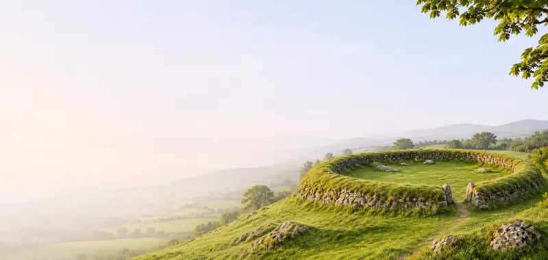
The monastic cashel consists of a large, roughly D-shaped enclosure (dims. c. 180m N-S; c. 145m E-W) with the straight side running along the E shore of the island. It is defined by a substantial drystone wall (dims. H 1.5m; T 2.5m) with breaks in the wall at NE and SE. Two decorated Romanesque jambstones are visible in that at SE. They were first discovered in 1932-3 during maintenance works (ibid.). It has been suggested that they mark a 12th-century gateway into the monastery (Leask 1955, vol. 1, 13, 162; O'Keeffe 2003, 318; Halpin and Newman 2006, 171) but they do not appear to be in situ and were probably taken from a church doorway and re-inserted into the wall (Ní Ghrádaigh 2006, 28; Stalley 2008, 717). The remains of a series of small enclosures or subdivisions, defined by low grass-covered earth and stone banks, can be seen radiating out from the wall at SW and they are also clearly visible running across the SE half of the interior to the S and W of the churches. A 'Vault' depicted on the 1837 ed. of the OS 6-inch map in the ENE sector of the interior may be the remains of a burial vault of post-AD 1700 date. It is defined by grass-covered wall-footings.
Four (LF021-048005-/48009-/48010-, LF021-048011-) out of a possible total of six cross-slabs that were located on the island are now in the OPW depot in Athenry, county Galway. The other two cross-slabs (LF021-049012-/048013-) are unlocated. The remains of two enclosures (LF021-045001- and LF021-047----) lie c. 280m to the NNW and NW respectively. (Bigger 1900, 69-89; Crawford 1913, 326; Macalister 1949, vol. 2; English 1971, 148; Leask 1955, vol. 1, 50-51, 61; 1960, vol. 2, 72; vol. 3, 115; Moore 2007, No. 13)
LF021-048001-
References
- This monument is subject to a preservation order made under the National Monuments Acts 1930 to 2014 (PO no. 5/1981).
Archaeological Survey of Ireland, National Monuments Service (CC BY 4.0) · Compiled by Patrick F. O'Donovan, Caimin O'Brien · Updated 5 June 2013. It describes the site as it was when surveyed.
Folklore and traditions
According to legend, the island is named after Clothra, sister of the mythical Medbh/Meave, Queen of Connaught but in the 19th century it was known as ‘Quaker’s Island’ (AFM vol. 3, 98).
Visitors' notes
Badges are opinions of visitors - not verified facts. One vote per badge and visitor; no account needed.
Best time to visit
What's missing on this page?
Share a tip to find it
Share a local tradition or story
Suggest a correction
Suggest the right map location
Report a duplicate page
Ask a question
Do not include personal data. See our privacy notice.
Around Inchcleraun Early Medieval Ecclesiastical Site
Other heritage nearby
- Lady WellHoly well · 3.7 km
- Ballybrogan ChurchAncient church · 6.5 km
- Carnagh West RingfortRingfort · 7.6 km
- Scregg TombMegalithic tomb · 7.9 km
Recorded within 5 km
- 42 ringfortsArchaeological Survey of Ireland
- 8 ancient churchesArchaeological Survey of Ireland
- 6 holy wellsArchaeological Survey of Ireland
- 6 castlesArchaeological Survey of Ireland
- 2 abbeys & friariesArchaeological Survey of Ireland
- 2 monastic sitesArchaeological Survey of Ireland
Walks and trails
- Green Heartlands Cycle RouteRoad Cycling Trail · 219.6 km · nearest point 4.4 km
- Commons North - Woodland WalkWalking Trail · 2.4 km · nearest point 8.6 km
- Mote Park - Bluebell LoopWalking Trail · 1.6 km · nearest point 8.8 km
Outdoors, towns and places to stay
- Mote ParkForests · 9.5 km
- RindownWalled towns · 4.6 km
- RoscommonWalled towns · 13 km
Other attractions nearby
- Corlea Trackway Visitor CentreMuseums and Attraction · 11 km
What's on nearby
- The Last Wake at Doory Hall2026-11-06 · 18 km