


Unofficial guide. Not the National Monuments Service, the OPW, Fáilte Ireland or the landowner. Disclaimer
At a glance
- TypeCross - High cross
- StatusNational Monument
What to look for
- Carved scenes
- Ring
- Base
Picked out from the Archaeological Survey description below.
Can you visit?
- No source says it is open to the public.Most monuments in Ireland stand on private farmland.
- Ask the landowner before crossing fields, close gates, leave the stones as you find them.Visiting responsibly
History and description
National Monument No. 226 (Harbison 1970, 77). Situated on the S side of Kilgobbin Lane, adjacent to an open green area, downslope from Kilgobbin ecclesiastical complex (Harbison 1992, 116-7).
Full archaeological record 631 words
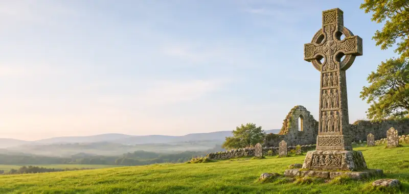
National Monument No. 226 (Harbison 1970, 77). Situated on the S side of Kilgobbin Lane, adjacent to an open green area, downslope from Kilgobbin ecclesiastical complex (Harbison 1992, 116-7). An incomplete ringed granite high-cross stands on the roadside 30m NW of Kilgobbin church (DU025-016001-) and graveyard (DU025-016002-). The broken condition of the head of the high cross was described by the Ordnance Survey in 1837 as follows; 'There is a stone cross with one arm broken off exhibiting a very rude representation of the crucifixion standing near this church (Herity 2001, 5). The southern side of the head of the ringed-cross is missing. The cross-head has the figure of Christ carved onto both faces, the E face representing the Crucifixion while the W face possibly represents the Risen Christ associated with the Last Judgement. A short possible tenon can be seen rising from the top of the cross-head which supported a possible small church-shaped capstone or a capstone of some other form which is now missing. The high cross was described by Ball (1905, 70-1) as; 'It is cut out of a piece of grey granite eight feet [2.4m] high, one foot four inches [0.4m] broad, and eight inches [0.2m] thick. It was originally three feet eight inches [1.1m] over the arms, but the southern arm, with the segment of the circle on that side, is broken off and lost. The cross had a small roll moulding round the edges, but not carried round the ring. On each face we can dimly see the figure of our Lord in the long garment reaching to the ankles. The shaft is carefully fitted into an oblong mortice in a shapeless base stone, which measures four feet nine inches across [1.44m], and has a bullaun, or shallow basin, one foot [0.3m] in diameter cut in its surface'.
The shaft (Wth 0.37m x T 0.2m) of the high cross (H 2.5m; head diam. 1.18m) which tapers towards the bottom, is morticed into a roughly rounded-boulder (Wth 1.45m x H 0.6m) forming the base of the high cross. The upper surface of this boulder has a bullaun (DU025-016012-) on its SW side. The edges of the cross-shaft are decorated with a roll moulding with the sides of the shaft bearing no decoration. Running up the centre of the shaft on the E face there is a moulding visible which forms an unidentifiable object at the feet of Christ. The E face of the head of the cross contains a crucifixion scene in low relief where a robed Christ is depicted with long arms outstretched horizontally. A second Christ figure, clothed in a long garment with short stubby arms is visible on the W face of the cross-head. This figure has shortened arms and Harbison suggested that his carving may represent the Risen Christ or Christ in Glory and compared this figure to a similar depiction on the pectoral cross in the Dumbarton Oaks collection (Harbison 1992, 117, 295). Harbison suggested that Kilgobbin Cross can be placed into a group of high crosses such as Cashel (TS061-025006-), Monaincha (TN018-001003-) and Roscrea (TN012-010018-) which depict Crucifixions later in date than an earlier group of high crosses. This group of later Crucifixions he divided into two groups. The cross at Kilgobbin falls into the group where Christ wears a long robe as opposed to the other group where Christ wears a perizonium or a loin-cloth (Harbison 1992, 283-4). The figure of Christ on the W face of Kilgobbin Cross has been compared to the figure of Christ on the E face of the high cross at Moone (KD036-031002-), Co. Kildare (Harbison 1992, 295). The cross at Kilgobbin is said to have been discovered buried in Kilgobbin graveyard (DU025-016002-) in the early 1800s and then re-erected in the present position.
References
- Date of revised upload: 8 May 2023
Archaeological Survey of Ireland, National Monuments Service (CC BY 4.0) · Compiled by Geraldine Stout and Margaret Keane. It describes the site as it was when surveyed.
Folklore and traditions
The cross at Kilgobbin is said to have been discovered buried in Kilgobbin graveyard (DU025-016002-) in the early 1800s and then re-erected in the present position.
More high crosses nearby
Kilteel Cross
Cross - High cross · Kilteel Upper · Kildare · 21 km away

St. Kevin's Cross
Cross - High cross · Sevenchurches Or Camaderry · Wicklow · 28 km away
Visitors' notes
Badges are opinions of visitors - not verified facts. One vote per badge and visitor; no account needed.
Best time to visit
What's missing on this page?
Share a tip to find it
Share a local tradition or story
Suggest a correction
Suggest the right map location
Report a duplicate page
Ask a question
Do not include personal data. See our privacy notice.
Around Kilgobbin Cross
Other heritage nearby
- Ballyedmonduff Wedge TombMegalithic tomb · 3.1 km
- Kilmashogue Megalithic TombMegalithic tomb · 3.9 km
- Tully ChurchAncient church · 4.5 km
- Cabinteely wedge tombMegalithic tomb · 4.7 km
- Kill of the GrangeAncient church · 4.7 km
- Rathmichael Early Medieval Ecclesiastical SiteMonastic site · 5.4 km
Recorded within 5 km
- 14 ringfortsArchaeological Survey of Ireland
- 13 castlesArchaeological Survey of Ireland
- 12 megalithic tombsArchaeological Survey of Ireland
- 10 ancient churchesArchaeological Survey of Ireland
- 8 monastic sitesArchaeological Survey of Ireland
- 7 standing stonesArchaeological Survey of Ireland
- 6 holy wellsArchaeological Survey of Ireland
- 2 high crossesArchaeological Survey of Ireland
- 1 stone circleArchaeological Survey of Ireland
Walks and trails
- Ticknock - Mountain Access routeWalking Trail · 2.6 km · nearest point 1.7 km
- Ticknock - Mountain Bike TrailsMountain Biking Trail · 14.5 km · nearest point 2.1 km
- Dublin Mountains WayLong Distance Waymarked Way · 41.2 km · nearest point 3.4 km
Outdoors, towns and places to stay
- TicknockForests · 2.1 km
- Tiknock MTB Forest ParkForests · 2.2 km
- Blackrock BathsBeaches · 5.8 km
- SeapointBeaches · 6.0 km · Excellent Quality (2025)
- Knocksink Wood Nature ReserveNature reserves · 6.7 km
- North Bull Island Nature ReserveNature reserves · 13 km
- DalkeyWalled towns · 7.8 km
- MulsoecourtWalled towns · 7.9 km
- Merrion MewsHistoric stays · 9.3 km
- Georgian TownhouseHistoric stays · 10 km
Other attractions nearby
- Adams & ButlerNature and Wildlife · 3.7 km
- Airfield EstateGardens · 3.7 km
- Wonderful Ireland Walking HolidaysWalking · 4.0 km
- Marlay ParkNature and Wildlife · 4.5 km
What's on nearby
- Why Magic?2026-11-05 · 3.9 km
- ON ICE Dundrum2026-11-05 · 4.1 km
- Andy Irvine & Quilty2026-11-05 · 7.0 km
Excavations nearby
- 06E227 Sandyford to Cherrywood Extension, Murphystown, County DublinRoad-scheme excavation report (TII) · 1.3 km
- 06E944 Laughanstown, County DublinRoad-scheme excavation report (TII) · 4.4 km