


Unofficial guide. Not the National Monuments Service, the OPW, Fáilte Ireland or the landowner. Disclaimer
At a glance
- TypeCross - High cross
- Recorded sizeH 2.62m; W 1.1m
- StatusNational Monument
What to look for
- Ring
- Base
Picked out from the Archaeological Survey description below.
Can you visit?
- No source says it is open to the public.Most monuments in Ireland stand on private farmland.
- Ask the landowner before crossing fields, close gates, leave the stones as you find them.Visiting responsibly
History and description
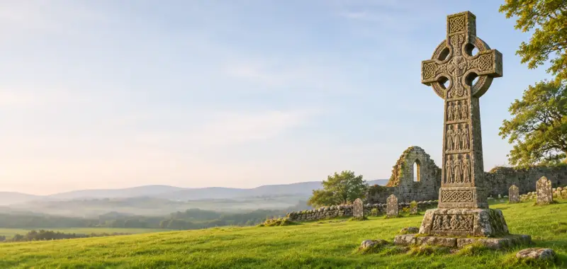
Three sandstone high crosses that are rather plain apart from roll mouldings, the base of another, a cross-slab and an ogham stone are displayed in the graveyard (ME016-006007-) of the early monastery of Diseart Chiaran (ME016-006----) (O'Connell 1957). The north cross (H 2.62m; Wth 1.1m) is ringed and has a shaft (0.53m x 0.47m) on a pyramidal base (dims at base 1.04m x 1m; H 0.75m).
Full archaeological record 88 words
Three sandstone high crosses that are rather plain apart from roll mouldings, the base of another, a cross-slab and an ogham stone are displayed in the graveyard (ME016-006007-) of the early monastery of Diseart Chiaran (ME016-006----) (O'Connell 1957). The north cross (H 2.62m; Wth 1.1m) is ringed and has a shaft (0.53m x 0.47m) on a pyramidal base (dims at base 1.04m x 1m; H 0.75m). There is interlace at the ends of the arms and on the E face of the ring. (Harbison 1992, vol. 1, 41-2)
Archaeological Survey of Ireland, National Monuments Service (CC BY 4.0) · Compiled by Michael Moore · Updated 6 June, 2014. It describes the site as it was when surveyed.
Also recorded nearby
Named sites within 5 km with only a short entry in the Archaeological Survey.
- Castlekeeran CrossesCross - High cross · Castlekeeran · 0.0 km · official record
The base of a high cross is within the graveyard (ME016-006007-) at the site of the early monastery of Diseart Chiarin (ME016-006----) (O'Connell 1957, 24).
Visitors' notes
Badges are opinions of visitors - not verified facts. One vote per badge and visitor; no account needed.
Best time to visit
What's missing on this page?
Share a tip to find it
Share a local tradition or story
Suggest a correction
Suggest the right map location
Report a duplicate page
Ask a question
Do not include personal data. See our privacy notice.
Around Castlekeeran Crosses
Other heritage nearby
- Castlekeeran Church ruinAncient church · 0.0 km
- St. Columb's HouseAncient church · 5.0 km
- Kells Round TowerRound tower · 5.1 km
Recorded within 5 km
- 39 ringfortsArchaeological Survey of Ireland
- 4 ancient churchesArchaeological Survey of Ireland
- 4 castlesArchaeological Survey of Ireland
- 3 high crossesArchaeological Survey of Ireland
- 2 holy wellsArchaeological Survey of Ireland
- 2 standing stonesArchaeological Survey of Ireland
- 1 ogham stoneArchaeological Survey of Ireland
- 1 hillfortArchaeological Survey of Ireland
- 1 abbey or friaryArchaeological Survey of Ireland
Walks and trails
- Drewstown Woods - Girley Bog walkWalking Trail · 5.2 km · nearest point 6.2 km
Outdoors, towns and places to stay
- Girley BogForests · 6.2 km
- Deerpark - VirginiaForests · 14 km
- The Cut, Lough LeneBeaches · 18 km · Excellent Quality (2025)
- KellsWalled towns · 5.2 km
- AthboyWalled towns · 13 km
- Lough Bishop HouseHistoric stays · 24 km
Other attractions nearby
- Spire of Lloyd and People's ParkHistoric Houses and Castle · 3.3 km
- Kells High CrossesHistoric Houses and Castle · 5.1 km
- St Columba's ChurchHistoric Houses and Castle · 5.1 km
- Kells Courthouse - Tourism and Cultural HubHistoric Houses and Castle · 5.7 km
What's on nearby
- Samhain Festival of Food & Culture2026-11-05 · 5.7 km
- The Samhain Literary Pub Crawl2026-11-06 · 5.4 km
- Samhain Festival of Food & Culture2026-11-06 · 5.7 km
Excavations nearby
- E3177 Castlekeeran 2, County MeathRoad-scheme excavation report (TII) · 0.6 km
- E3178 Castlekeeran 1, County MeathRoad-scheme excavation report (TII) · 0.9 km