

Unofficial guide. Not the National Monuments Service, the OPW, Fáilte Ireland or the landowner. Disclaimer
At a glance
- TypeCross - High cross
- Date or period mentionedearly Christian
What to look for
- Carved scenes
- Base
- Inscription
Picked out from the Archaeological Survey description below.
Can you visit?
- No source says it is open to the public.Most monuments in Ireland stand on private farmland.
- Ask the landowner before crossing fields, close gates, leave the stones as you find them.Visiting responsibly
History and description
Carrowmore ecclesiastical complex has been identified with Both Chonais an early monastic site (Gwynn and Hadcock 1970, 30). The site consists of a series of monuments (DG011-049----/049010-) divided by a modern road, but obviously it originally formed part of a larger unit.
Full archaeological record 395 words
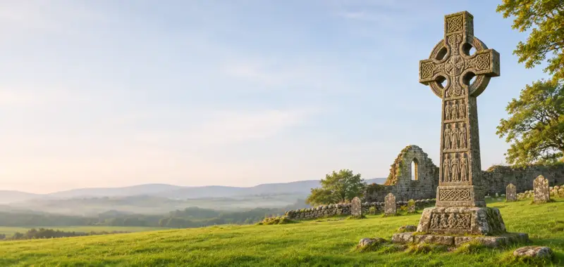
Carrowmore ecclesiastical complex has been identified with Both Chonais an early monastic site (Gwynn and Hadcock 1970, 30). The site consists of a series of monuments (DG011-049----/049010-) divided by a modern road, but obviously it originally formed part of a larger unit. On the W side of the road there is a rectangular enclosure of a burial ground (DG011-049001-). Near the SW corner of the enclosure two jamb-stones 1.5m apart, and at right-angles to the line of the wall, probably indicate an entrance. Just beyond the N side of this wall is a flat-topped boulder (DG011-049003-) which may be the base of a high cross. Inside the dividing wall is a possible cross-slab (DG011-049004-) partially buried in the ground. Also close to the S end is a tall plain high cross (DG011-049005-). E of the road is a second high cross (DG011-049006-) standing 2.8m high and 1.3m wide at the arms. At the top of this cross is a very indistinct trace of a standing figure flanked by two angel-like figures. This cross often referred to as the South Cross was described by Harbison (1992, 33) as following: 'A ringless cross, 2.85m high and measuring 1.35m across the arms, stands in a field adjacent to the National School. The shaft is 77cm wide and 20cm thick. The east face is plain. WEST FACE MAJESTAS DOMINI - (Rowan-an angel), Cut out in low false relief on the upper part of the west face is a figure of Christ, clothed in a cut-away garment and with his feet in profile. He is flanked on each side by an angel in profile.'
There is a small cairn (DG011-049007-) possibly a penitential cairn of stones about the base of the cross. This cairn is marked on the 1903 ed. OS 6-inch map (Lacy et. al. 1983, 248). 18m to the S there is an earth-fast cross-inscribed boulder (DG011-049008-). To the NE against a field and townland boundary there was a holy well (DG012-021---) which has been closed up (Ó Muirgheasa, No. 94). In 2012 the Bernician Studies Group carried out a magnetometer survey in the fields surrounding the high crosses (DG011-049005-/006-) at Carrowmore which revealed the sub-surface remains of a bi-vallate early Christian ecclesiastical enclosure (DG011-049----) (O'Brien and Adams 2014, 4). The magnetometer survey shows that the South Cross stands outside the outer enclosing element of the ecclesiastical enclosure.
References
- Date of revised upload: 4 March 2015
Archaeological Survey of Ireland, National Monuments Service (CC BY 4.0) · Compiled by Brian Lacey with Eamon Cody, Claire Cotter, Judy Cuppage, Noel Dunne, Vincent Hurley, Celie O'Rahilly, Paul Walsh and Seán Ó Nualláin (Lifford: Donegal County Council, 1983). In certain instances the entries have been revised and updated. It describes the site as it was when surveyed.
More high crosses nearby


Visitors' notes
Badges are opinions of visitors - not verified facts. One vote per badge and visitor; no account needed.
Best time to visit
What's missing on this page?
Share a tip to find it
Share a local tradition or story
Suggest a correction
Suggest the right map location
Report a duplicate page
Ask a question
Do not include personal data. See our privacy notice.
Around Carrowmore South Cross
Other heritage nearby
- Carrowmore Early Ecclesiastical SiteMonastic site · 0.0 km
- Clonca Church & CrossAncient church · 1.6 km
- Laraghirril Court TombMegalithic tomb · 2.4 km
- Bocan stone circleStone circle · 3.2 km
- St Buadan's Church of IrelandAncient church · 3.7 km
- St. Adamnan's WellHoly well · 3.8 km
Recorded within 5 km
- 29 ringfortsArchaeological Survey of Ireland
- 9 standing stonesArchaeological Survey of Ireland
- 6 holy wellsArchaeological Survey of Ireland
- 6 megalithic tombsArchaeological Survey of Ireland
- 4 high crossesArchaeological Survey of Ireland
- 3 ancient churchesArchaeological Survey of Ireland
- 1 monastic siteArchaeological Survey of Ireland
- 1 stone circleArchaeological Survey of Ireland
Walks and trails
- Meenavogey TrailWalking Trail · 2.9 km · nearest point 9.5 km
- Old Carn Road Drovers TrailWalking Trail · 7.3 km · nearest point 12 km
- Slí Croí Inis EoghainWalking Trail · 5.5 km · nearest point 12 km
Outdoors, towns and places to stay
Other attractions nearby
- St Patrick's Cross CarndonaghAbbeys and Monastery · 5.3 km
- True North BoatingNature and Wildlife · 5.3 km
- Adventure Sports CuldaffWalking · 5.4 km
- Kinnagoe BayNatural Landscape · 11 km